REASONS TO BUY
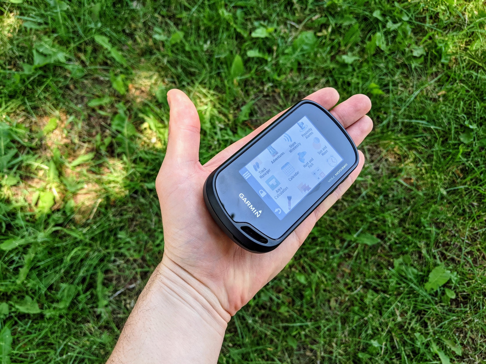
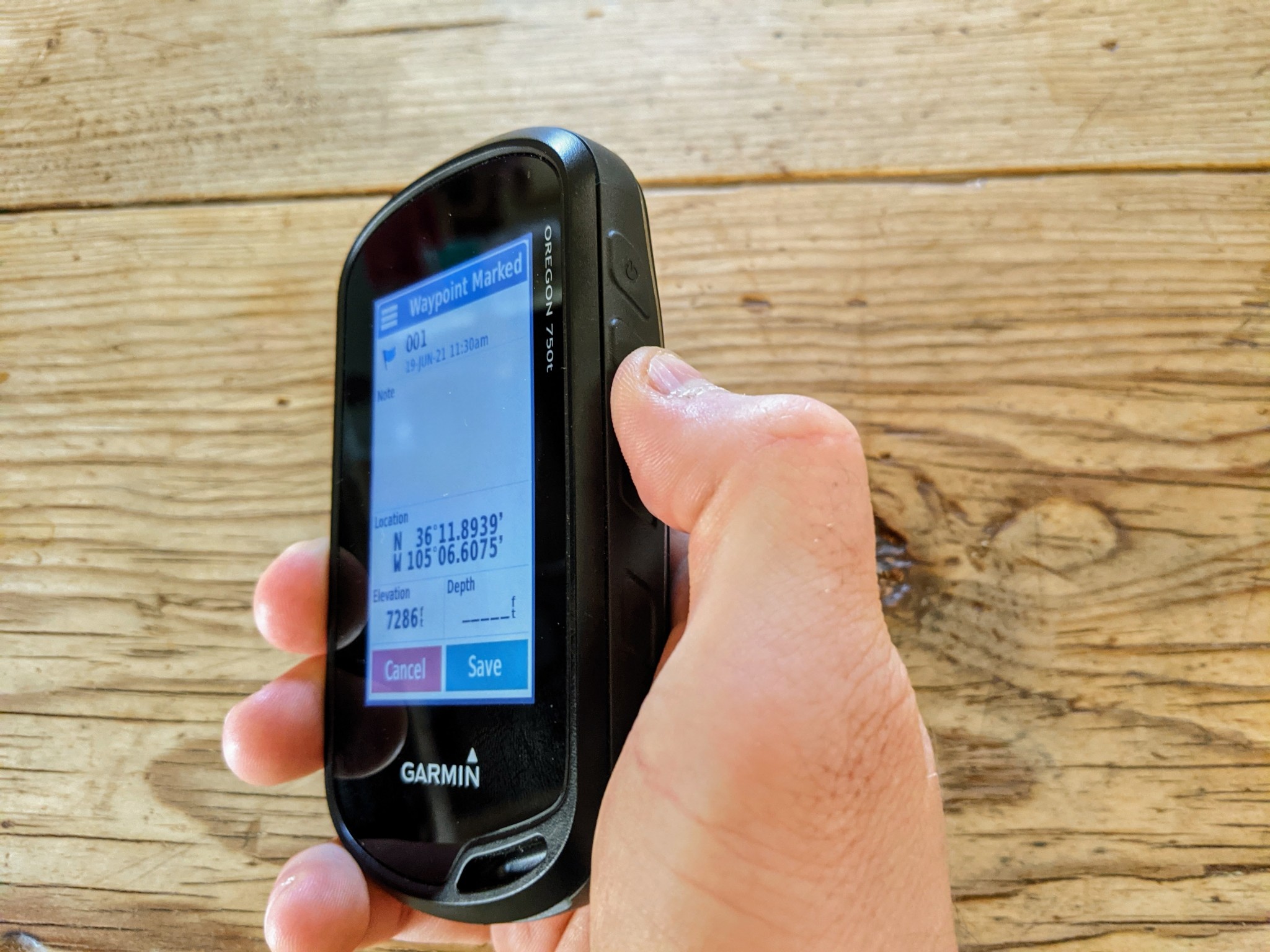
Straight-forward touchscreen interface
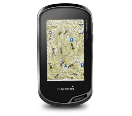
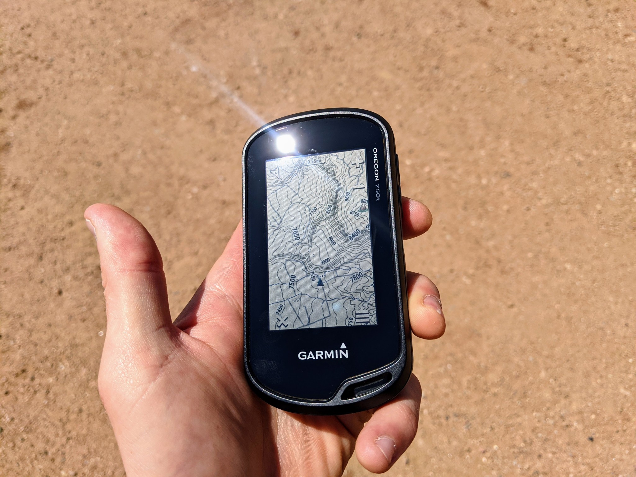
Preloaded topo maps
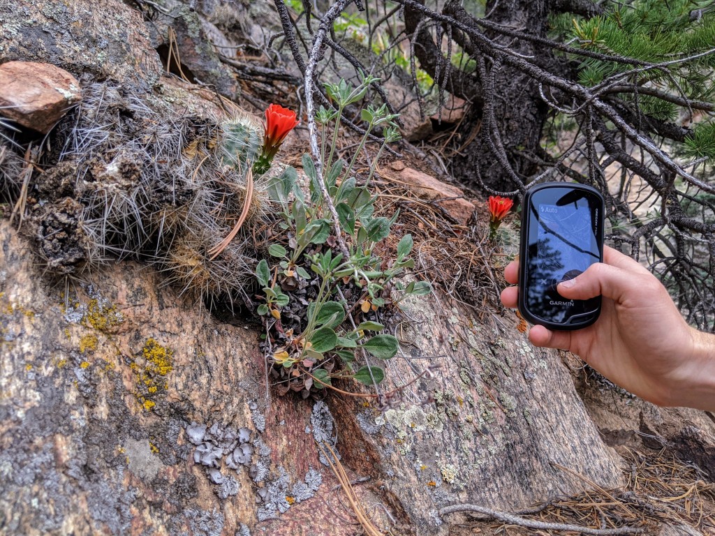
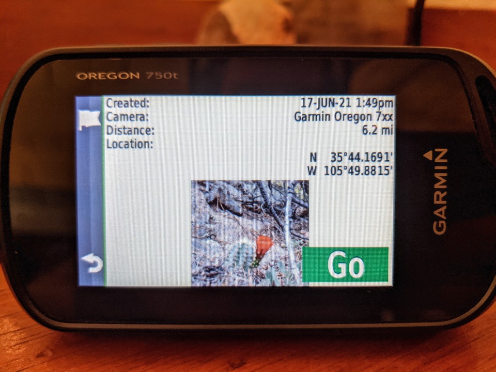
Camera for easy geo-tagging and sharing
REASONS TO AVOID
Touchscreen performance when wet
Potential battery issues
Expensive

The Garmin Oregon 750t is familiar because its handling size and touchscreen are reminiscent of your smartphone. Preloaded Topo 100K maps for the US, and pre-established user profiles for activities like hiking, bike touring, and geocaching make this unit easy to power up and go. An 8MP camera — which automatically geotags photos — plus its connectivity to Garmin Connect via WiFi or Bluetooth improves sharing capability. The purchase price of the Oregon 750t also includes a 1-year subscription to Garmin's BirdsEye Satellite Imagery to improve mapping capability.
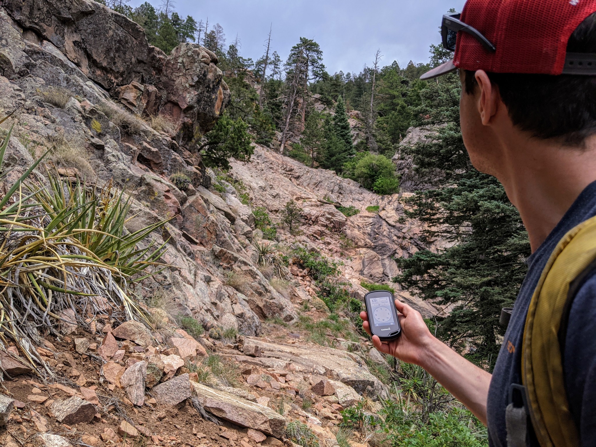
The reception of the Oregon 750t is outstanding, especially when considered side-by-side with the capability of other comparably sized handheld units. Like all of Garmin's units, this one has the ability to access both GPS and GLONASS satellites, as well as the option to toggle WAAS/EGNOS signal correction on/off for improved position accuracy — though with the tradeoff of battery usage, of course. With GPS and GLONASS connections, but without WAAS enabled, we are able to regularly achieve accuracy down to 8 feet. The only time this unit seems to waver in terms of signal strength is in narrow canyons — but even then, as long as it has a clear sky view, it will only occasionally drop into 4/5 bars.
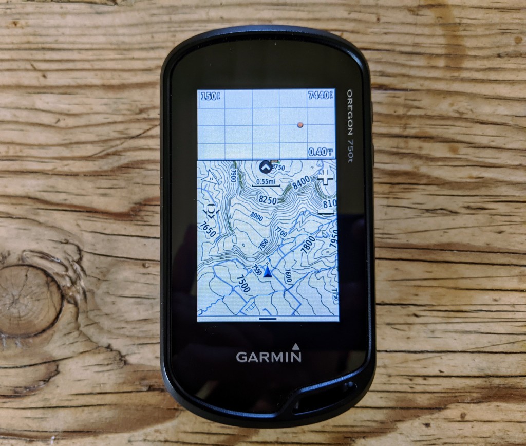
Garmin is kind enough to include a TOPO 100K basemap — or a 1:100,000 topographic map — for the country of purchase (in our case, this unit came with a US basemap.) This addition is a huge improvement over previous models, which didn't come with any preloaded maps. Although this is still less than 1/4 of the resolution offered on your standard USGS topographic map — which is 1: 24,000 resolution — the ability to zoom into a 20-foot resolution on the map is more than ample accuracy for easily navigating along a bearing or contour line.
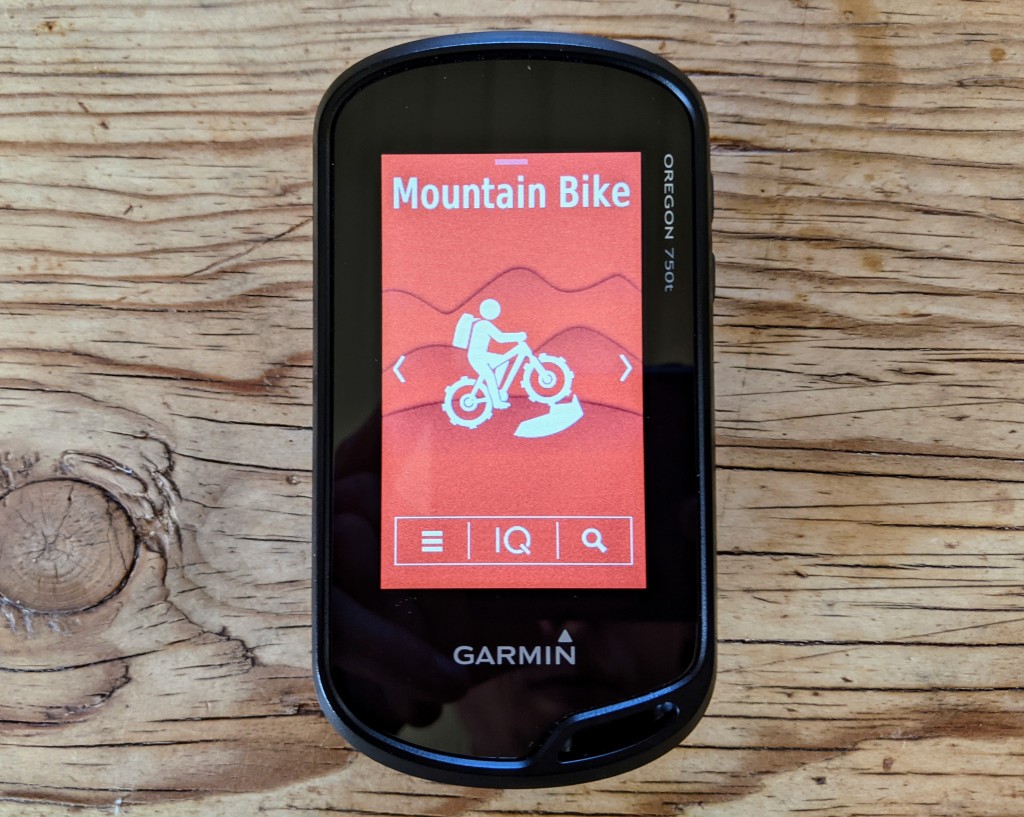
Likely the most appealing part of the Oregon 750t is the touchscreen, which is intuitive to use for all of us who are accustomed to the interface of our smartphones. Although the touchscreen draws heavily on the more limited 16-hour battery life, the ease of use is well worth the tradeoff for all but those looking for an expedition GPS. Upon boot-up, it launches to an activity-select screen, which offers pre-set profiles and special overlays for activities like hiking, mountain biking, hunting, climbing, and geocaching. For example, selecting the “tour cycle” preset provides a map overlay of speed, direction, distance to destination, and a trip odometer. While other units provide many of the same options, often, they are buried under a series of menus rather than offering the user-friendly experience of this unit. The Oregon 750t can also link to your smartphone via WiFi and/or Bluetooth for improved capability when you have internet access.
Smaller than your average smartphone but larger than any of the options in the eTrex series, this offers a nice balance of size and display quality. The design of the Oregon 750t maximizes screen space, with a 3.75 square-inch, 241 x 400 resolution screen — directly comparable to the screen size and quality on the award-winning Garmin GPSMAP 66st — but on a unit that is 2 inches shorter. The brightness can be adjusted, and the transflective screen is easily readable even in direct sunlight. Although the screen is dual-orientation — it can be set to lock or self-orient between portrait and landscape mode — and ample relative to the size of the unit, it is still a bit too small to choose over a smartphone for turn-by-turn driving navigation.
Like we've expressed before, this GPS strikes a nice balance between larger, more capable units and smaller, more stripped-back versions. On average, this unit achieves signal acquisition with enough accuracy for an approximate location in 1 minute, 11 seconds, which is more than respectable. But relative to processing speed, the Oregon 750t really stands out — the accelerometer-supported electronic compass and barometric altimeter allow for a quick position read. This unit actually processes smoother than other, otherwise more capable units. Particularly, the compass and map orientation update without any lag-time, offering a real-time experience which is particularly useful when navigating on a bearing.
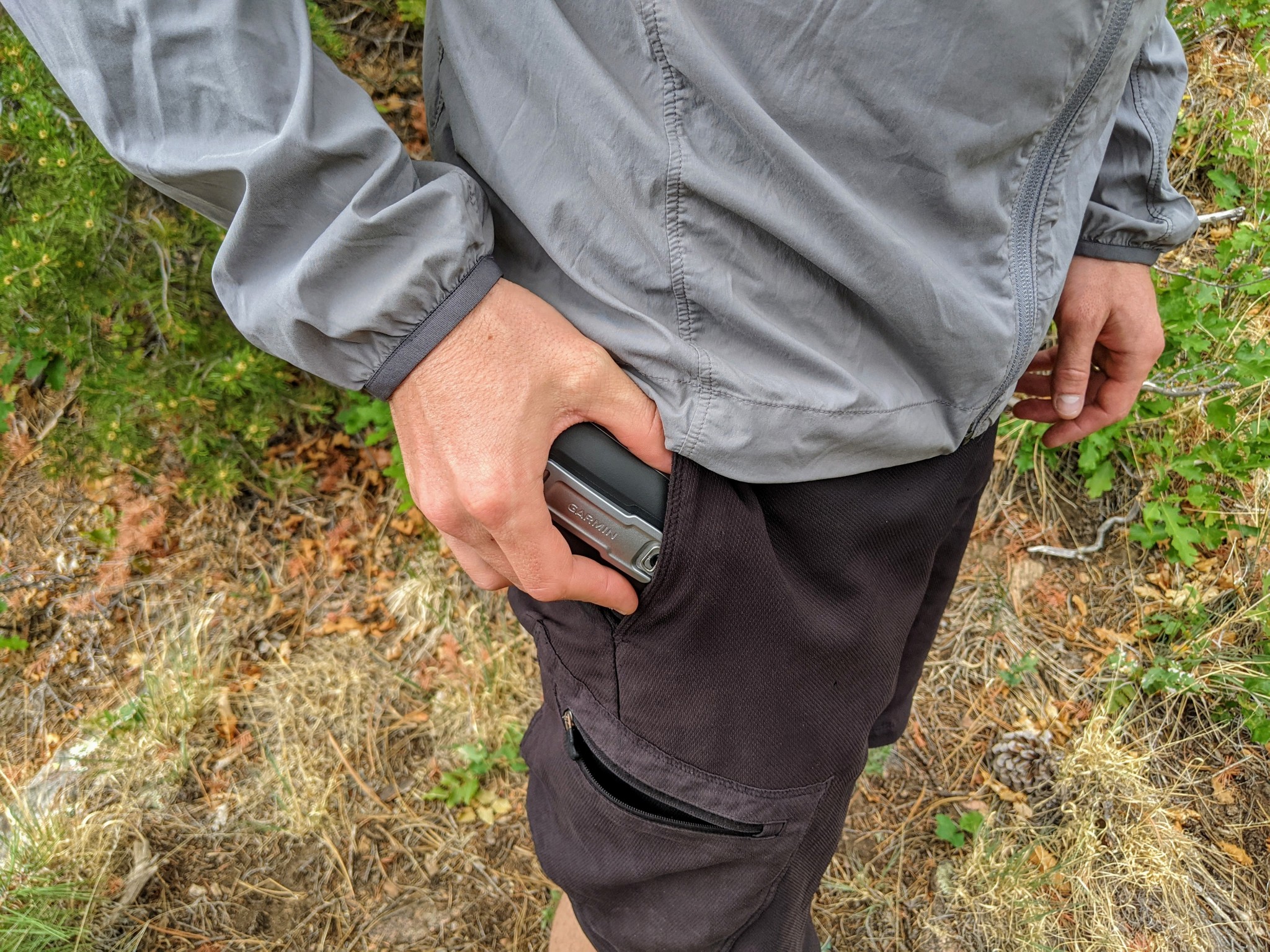
The 10.8 square-inch Oregon 750t is smaller size-wise than your average smartphone. Although it is thicker because of a heftier battery pack, the shell-like design contours comfortably to your closed hand and feels sturdier to hold than a smartphone. Weighing in at just over 7 ounces (with batteries), it is a minuscule weight and size addition to any backpacking or ski-touring kit — even for an ultra-light crowd.
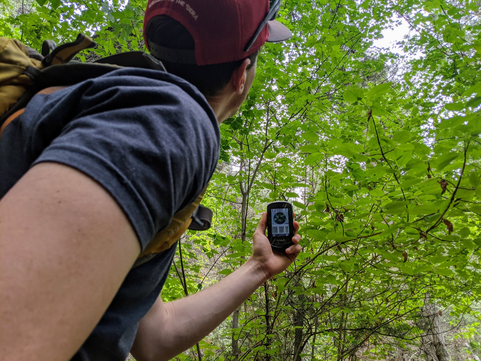
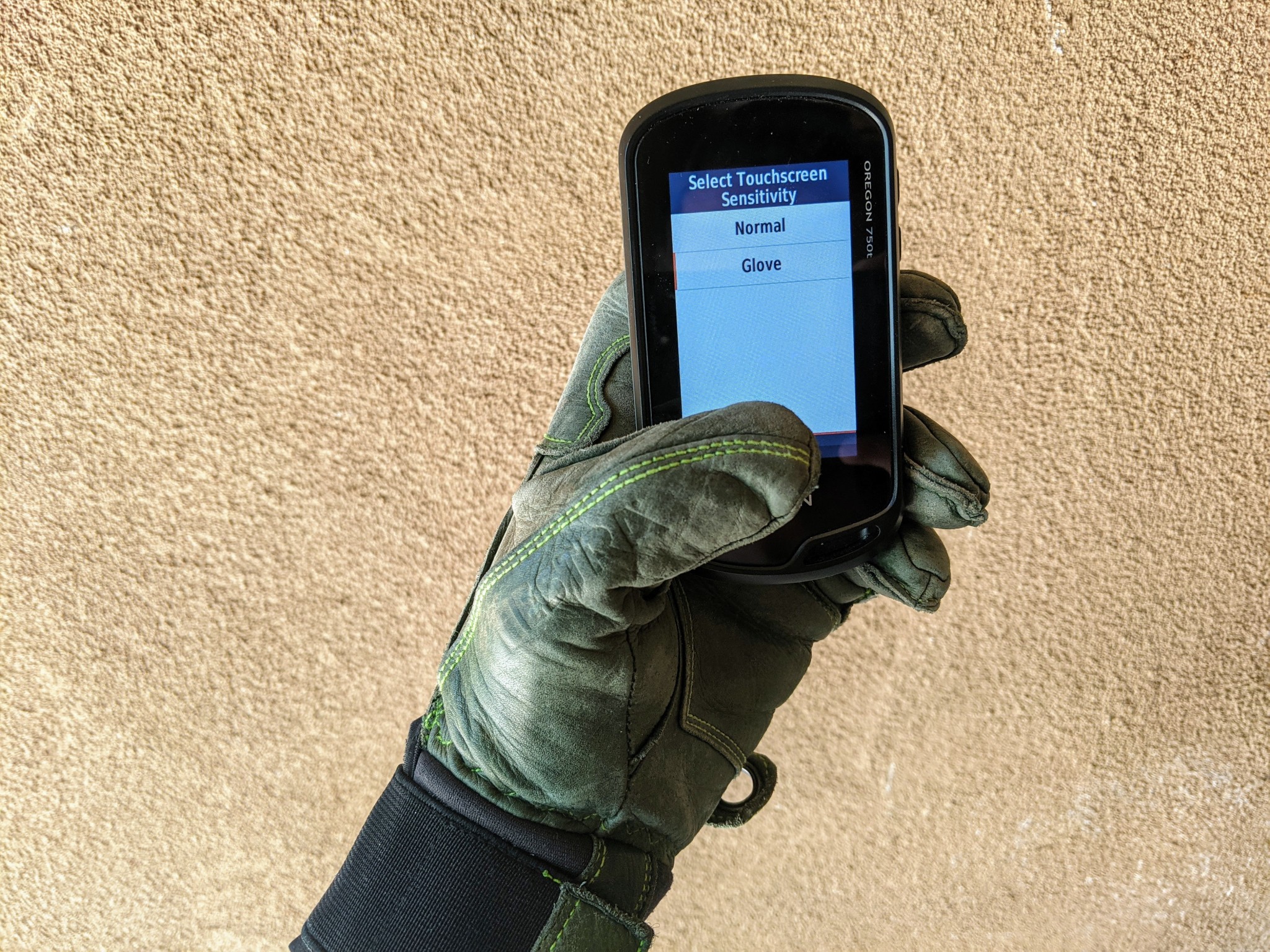
As evidenced by the preset activity profiles, the Oregon 750t is an ideally-sized GPS capable of finding its place and purpose for many different types of adventure. It is small and lightweight enough for backpacking, hiking, or hunting. Its mounting capability, touchscreen, plus customizable profiles make it a nearly ideal unit for tour cycling or bikepacking. Previous models had issues with cold-weather functionality; you can adjust the screen sensitivity for improved use with gloves. While it is remarkably easy to use the touchscreen with gloves, the capability to deftly navigate screens quickly fades whenever this IPX7-rated unit gets wet — the unavoidable downside of any touchscreen.
The Oregon 750t performs well across the board. As a highly functional, highly versatile unit, you can expect this unit to carry a price tag worthy of its performance. More expensive units will offer more nuanced capability, and more price-point options won't afford the same intuitive design or comfortable feeling of using a smartphone.