We buy all the products we test — no freebies from companies. If you purchase through our links, we may earn a commission, which helps support our testing.
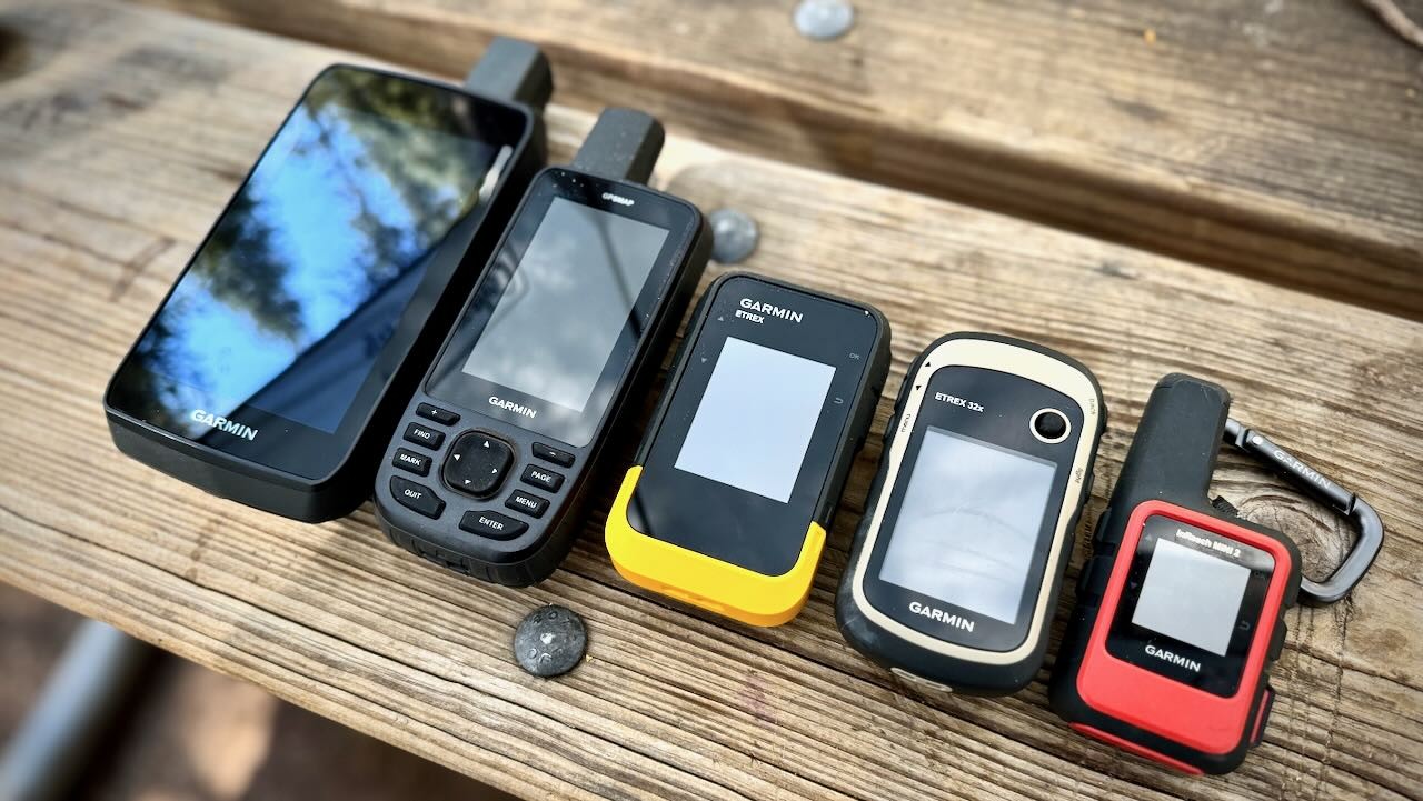
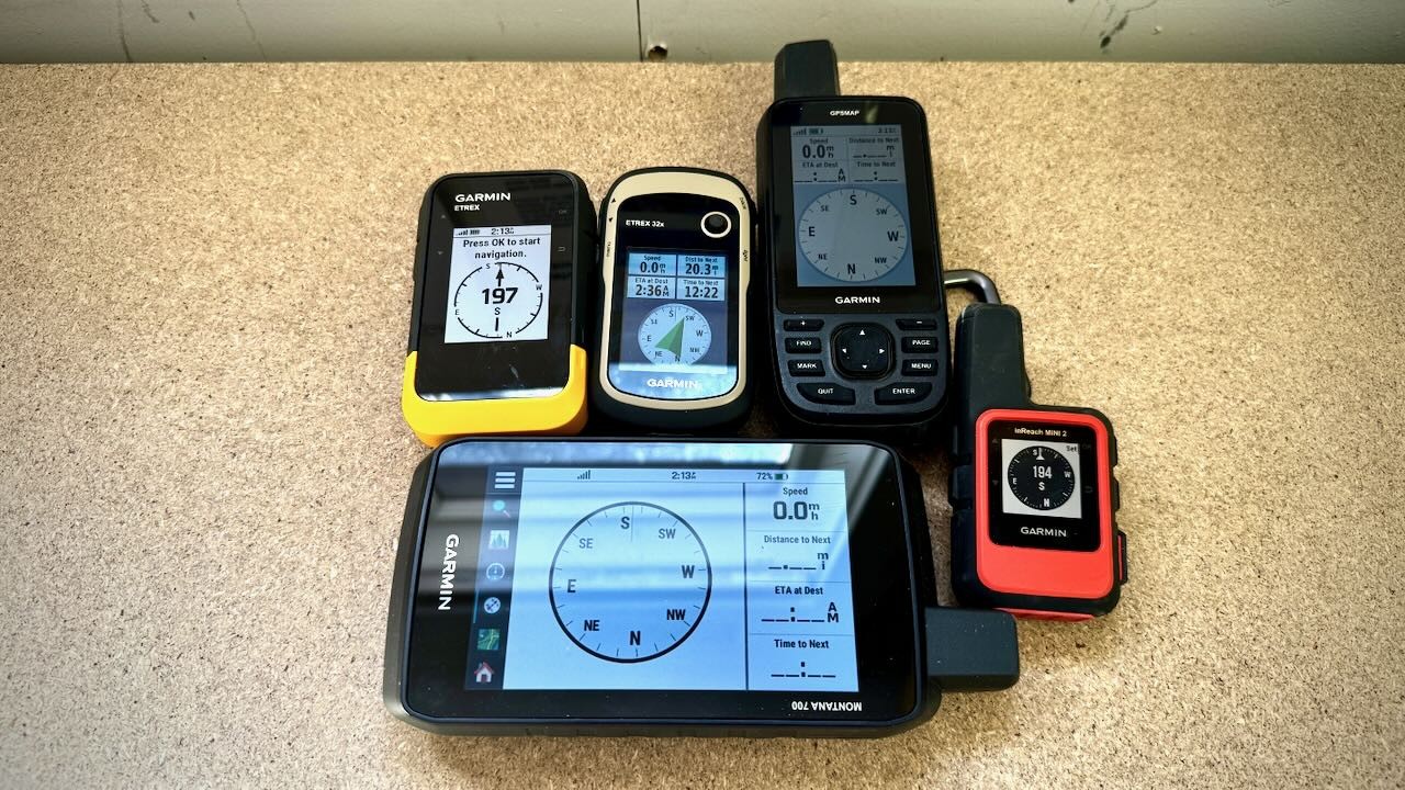
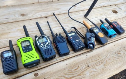
We took 5 of the best handheld GPS units and navigated through whiteouts, desert washes, fog-covered forests, and high mountain passes from Alaska to the Four Corners.
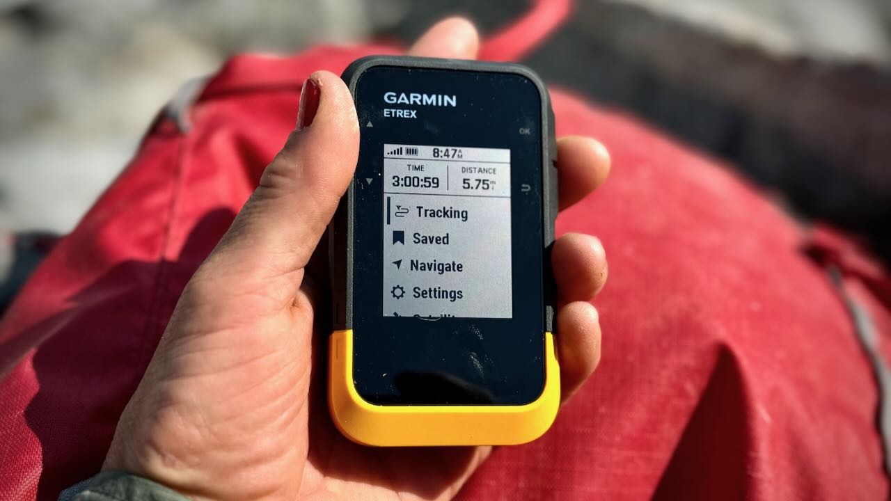
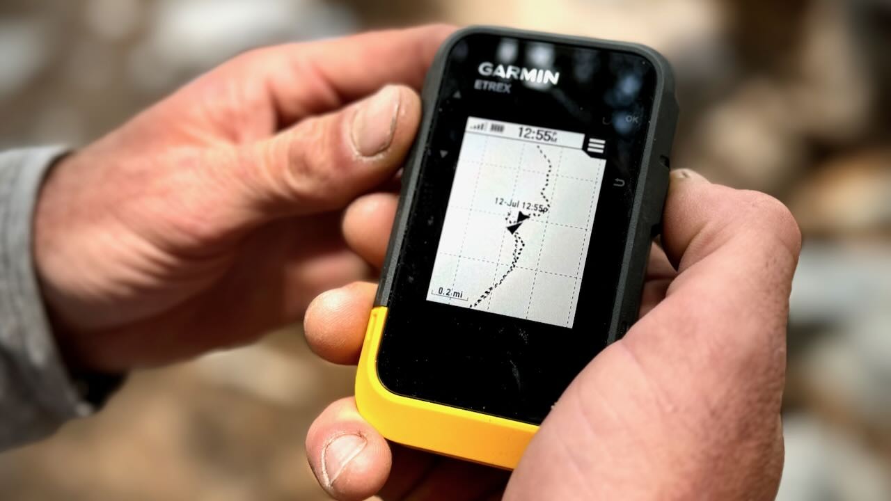
The Garmin GPSMAP 67 is the best model we tested. It scored the best for navigation and scored well across every other metric. If you have a smaller budget, consider the Garmin eTrex 32x, which is about half the price and has enough performance and features for most people.
Editor's Note: We updated our handheld GPS review on November 4, 2024, adding two new devices, removing some discontinued models, and sharing updated media and testing perspectives for each device that remains.
Excellent reception, feature-rich design, large buttons increase functionality in cold and wet conditions, larger screen is easier for viewing, smart notifications and connectivity
Super compact, lightweight, excellent battery life (far superior to smartphone battery), accurate tracking, versatile, great for basic communication, user-friendly interface, buttons (rather than touch screen) allowing for use with gloves in cold weather
Reasonably priced, features heavy, includes a barometric altimeter and electronic compass, relatively small and lightweight
Huge and modern touchscreen, fast processing speed, shock and water-resistant construction, adequate battery life, user-friendly interface
Most affordable option tested, long battery life, push buttons for use in colder climates, monochrome screen is bright and easy to view
Cons
Expensive, bulky, outdated interface when compared to modern smart technology, complicated connectivity between devices
Requires monthly subscription for communication and messaging, extra time and setup required to sync device to apps for use in the field, small display screen
Tiny screen with dim lighting, lacks connectivity, tedious and outdated user interface
Big and heavy, expensive, not practical for handheld backcountry use
No pre-loaded maps or ability to download maps, very limited navigation options, only 28 MB of memory with no micro SD card compatibility
Bottom Line
A trustworthy and feature-rich handheld GPS option that remains lightweight and easy to use (even in cold temperatures) with an exceptionally long battery life
A compact navigation and satellite communicator perfect for providing peace of mind in the backcountry, offering the option to send notes to loved ones, mark waypoints, and track activity
The addition of an altimeter and electronic compass make this lightweight unit one of the most cost-effective options on the market
An extremely capable and user-friendly handheld unit, but with a size and design better suited to mounting on an ATV or touring motorcycle
This basic push-button navigation device is perfect for those seeking a long battery life that will remain functional in cold weather, with accurate tracking, a digital compass, and live geo-caching updates
Wireless notifications and data sharing between devices
Includes topo maps and Bird's Eye Imagery (without a subscription)
REASONS TO AVOID
Expensive
Bulkier and heavier than most
Advanced features hide behind complex menus
SPECIFICATIONS
Measured Dimensions
6.4"L x 2.5"W x 1.4"D
Measured Weight With Battery
8.1 oz
Measured Volume
22.4 cu in
Battery Life - GPS Mode (Per Manufacturer)
180 hrs
Battery Life - Expedition Mode (Per Manufacturer)
840 hrs
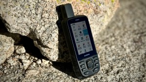
The Garmin GPSMAP 67 is at the top of its class in terms of accuracy and reliability, earning it our top honors. It boasts a powerful quad-helix antenna and reliably connects to more satellite networks with greater accuracy than most other models. The lithium battery is also a huge improvement to this modern design, offering roughly 160+ hours in default mode and upwards of 800 hours in the battery-saving expedition mode. Even in less-than-ideal locations, such as below dense forests and tree canopies or within a tight slot canyon, the GPSMAP 67 can maintain a satellite connection due to its multi-band technology. When in the range of cell service, this unit can pair with your smartphone to overlay real-time weather data on your maps. Its 16GB of internal memory is more than double what is offered by most other units and comes preloaded with topo maps for the US and Canada and subscription-free access to Garmin's Bird's Eye Imagery (a program that offers more detailed, high-resolution satellite imagery).
All of these attributes will cost you a good chunk of change. Yet, the Garmin GPSMAP 67 is worth every penny for those who plan on embarking on expeditionary trips or need high accuracy for field research. As for casual recreation, this device might be a little overkill. Additional features, such as wirelessly linking to your phone, require a cumbersome setup process, and navigating the many features within the main menu definitely requires some trial and error. Although it lacks a built-in touchscreen, our testers appreciate the sizable buttons and intuitive layout. If a touch screen is more important to you for navigation and you don't mind a little extra weight and space, check out the Garmin Montana 700 for a more modern user interface. And if you are just after something basic with long-lasting battery life, the Garmin eTrex SE could be the perfect companion to use alongside your smartphone. The Garmin GPSMAP 67 is undoubtedly a powerful and feature-rich GPS device with a long battery life, yet it's also easy to use, even in the most extreme cold weather field conditions.
The GPSMAP 67 is a feature-rich and rugged GPS unit that supplies lasting battery life while remaining relatively lightweight.
Includes a barometric altimeter and electronic compass
Compact and lightweight
REASONS TO AVOID
Small screen
Lack of connectivity
Tedious user interface
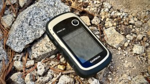
If you're in the market for a straightforward GPS unit that sacrifices little when it comes to pure navigation performance, the Garmin eTrex 32x is a prime choice. It performs well beyond its weight class when compared directly with more advanced models. An excellent value that does not skimp in reception and processing speed, this device comes preloaded with Garmin's TopoActive basemap (that provides a variety of features including urban and wilderness trails, contour lines, points of interest, etc.) that supplies adequate data for those who don't want to mess with the process of searching for and uploading individual maps. The software will be loaded based on where you purchase the device, so if you purchase your handheld in California, it will come preloaded with maps for North America (including the US, Canada, Mexico, etc. Its impressive navigational accuracy is the result of linking multiple networks, including GPS and GLONASS, to pull information from numerous satellites in order to identify your specific location, a tracking feature that is then improved with the addition of a barometric altimeter and a 3-axis digital compass. Yet, these enhanced capabilities somehow don't affect the eTrex 32x's size and weight. Just as small and lightweight as other units in the eTrex line, this compact GPS can easily be stowed away in a pack or tossed into a pocket for a day hike.
While certainly impressive, the eTrex 32x does have some limitations. Despite its routable navigation ability, the fairly tiny screen is not reasonable for navigating around a new city via car or even daily driving. It is also still very much a base-level GPS unit. Although it supports Garmin's BirdsEye Satellite Imagery, it doesn't offer the same level of connectivity offered by more advanced models. For instance, the device is only connected via ANT+ rather than Bluetooth and Wifi, and it is not possible to link the device to any integrated apps such as Garmin Connect and Garmin Messenger. Likewise, many user groups that have grown accustomed to modern interfaces will find the joystick and T9-style keyboards cumbersome or even tedious to work with when compared to the normalized convenience of a touchscreen. Again, if you're not interested in stepping back in time, check out the Garmin Montana 700. Although it is much larger and heavier than the eTrex 32x, it offers the only modern touchscreen we tested, along with a feature-rich design that's perfect for navigation. That being said, as a plug-and-play option for simple navigation or a durable, compact, and capable GPS for expeditions, the eTrex 32x presents a more affordable option with advanced features and capabilities.
Although the joystick design taking a little getting used to, the main menu of the eTrex 32x offers a ton of feature within a lightweight and more affordable design.
User-friendly and intuitive design can be operated in cold weather
REASONS TO AVOID
Expensive
Monthly subscription required to activate satellite messaging
Micro-size display screen
SPECIFICATIONS
Measured Dimensions
3.9"L x 2.0"W x 1.0"D
Measured Weight With Battery
3.5 oz
Measured Volume
7.8 cu in
Battery Life - GPS Mode (Per Manufacturer)
336 hrs
(Times reflect standard activity at 10-min intervals with full sky view. Actual performance varies based on specific use configuration.)
Battery Life - Expedition Mode (Per Manufacturer)
720 hrs
(Times reflect standard activity at 30-min intervals with full sky view. Actual performance varies based on specific use configuration.)
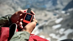
The Garmin inReach Mini 2 is a perfect companion for those who want to stay connected while exploring the backcountry. Whether you need an updated weather report, want to provide peace of mind to your loved ones, or need to record an accurate track to trace your route, this tiny unit weighs just 3.5 ounces and measures only 7.8 cubic inches, so it easily stows away inside your pocket or latches onto your backpack shoulder strap (thanks to a Garmin specific carabiner included with your purchase). No other option in our lineup boasts such a small size paired with an equally robust feature set. For comparison, the top-performing Garmin GPSMAP 67 weighs more than double the Mini 2 and is 2.5 inches longer, while the Garmin Montana 700 is a whopping 3.5 times heavier and yet another full inch larger in each direction. The Mini 2 relies on smart design choices and powerful Garmin Apps to deliver enhanced capabilities — Messenger for texting and Explore for robust mapping tools — while still living up to its diminutive name. The Mini 2's battery life stands out as impressive, with up to 336 hours or 14 days of use when in default mode and up to 720 hours when set to expedition mode (depending on its exact configuration). It is also equipped with an SOS feature that alerts Search and Rescue teams to your specific location (thanks to satellite options from both Galileo and QZSS) should you have an emergency beyond cell phone range, and its digital GPS compass provides reliable navigation in the field, while the intuitive button design ensures the device is still usable while wearing gloves in cold weather.
This device is perfect for those who want peace of mind in the backcountry without the additional weight and bulk of a feature-rich GPS device. However, there are some limitations and concerns for users. First of all, the screen is tiny, at just over an inch in size, which can make it difficult for some users to view the information, particularly when paired with its monochrome display. Larger transflective color screens like that on the GPSMAP 67 or the Montana 700 touchscreen are inarguably going to be easier on the eyes. Also, an ongoing monthly subscription is required to take advantage of text and notification services via the Garmin Messenger app. These costs add up over time, which is an important consideration when assessing comparative pricing. There is also quite a learning curve when setting up this device to connect with external apps. Yet this smartphone App integration provides a demonstrably better user interface than using the device on its own, particularly when typing and sending important text messages. So, the upfront hassle is worth it to get your device dialed before you embark on your next adventure. All that being said, the Mini 2 is an excellent choice for those seeking a pocketable backcountry communication tool and navigation device. It can provide accurate tracking and navigation, the ability to easily check in with loved ones or fire off an SOS signal, the option to mark waypoints, and so much more. But, for those who carry a smartphone anyway and have no problem dropping communication when outside of regular cell service areas, a simple handheld GPS like the Garmin eTrex SE could be the perfect navigational companion. The SE is also reasonably compact at just 5.5 ounces and features a battery that can last up to 1800 hours in expedition mode, plus a larger 2-inch+ display for easier readability in the field. It also sells for a fraction of the cost of every other product we tested - less than half that of the Mini 2. When backcountry Messenger services are not a top priority, the eTrex SE is a worthy option to consider.
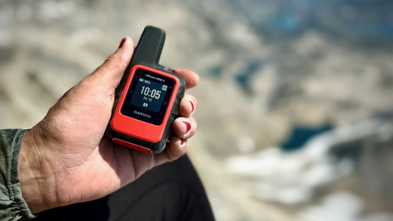
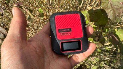
The Garmin inReach Mini 2 is one of the most compact and lightweight GPS units that we tested. With a monthly subscription, it offers satellite communication for those who want to stay connected while exploring the backcountry.
Credit: Gus Landefeld
Optional InReach Messaging Service Now Available
Several of Garmin's handheld GPS devices can now be purchased with InReach text and emergency SOS Messaging capabilities at a higher price. If you prefer the look and functionality of large, more feature-heavy models but backcountry communication is still important to you, be sure to take a look at devices that feature an “i” in their name, such as two of our award winners, the Garmin GPSMAP 67i or Garmin Montana 700i. Just keep in mind you will still have to set up and pay for the monthly subscription in order to take advantage of the service.
Compare Products
Off the grid locations like Ostrander Lake in Yosemite National Park were the perfect testing grounds for these GPS devices.
Credit: Trish Matheny
Why Trust GearLab
For the past 14 years, we've tested over 25 of the top handheld GPS units side-by-side. To test these devices, we assembled an all-star crew of outdoor adventurers. Our lead testers include Chris McNamara, the founder of OutdoorGearLab, who at one point was calculated to have spent 3% of his life on El Capitan in Yosemite; Amber King, who can equally be found teaching science to her students in Colorado or covering long distances in her backyard, by bike, raft, or on foot; Ethan Newman, a climbing and canyoneering guide in Southwest Utah; and Aaron Rice, a ski patroller, avalanche instructor, and wilderness guide in New Mexico. Last but not least is Trish Matheny, a current member of the Yosemite Search and Rescue Team who uses GPS devices both recreationally and professionally to communicate with friends during extended backcountry objectives or to locate missing persons within the intricate wilderness that surrounds Yosemite National Park.
These lead testers — plus scores of friends and partners — took to testing these GPS units in real-world situations. From mountaineering in Alaska to ski touring in the San Juan Mountains of Colorado and winding through the canyon country of the Southwest, our testers used these GPS units in whiteouts, in slot canyons, and while temporarily stranded by flash floods during unexpected storms. They have channeled all they've learned through their combined real-world adventures to now bring you insights to gauge the best device to meet your needs. Our rigorous assessment combined extensive hands-on time in the field with more objective testing back home, during which we evaluated everything from the accuracy of reception to each device's memory capability, size, and weight. We took time to compile research, closely examined feature sets and their ease of use, and noted when and how some devices shone where others failed. We utilized the expertise of our science-minded, adventure-obsessed testing crew to provide the most accurate, objective reviews available on the internet.
Our testers carefully evaluated the advertised manufacturer claims to determine the length of time required to charge each device, how quickly tracking drained the battery, as well as how long expedition mode could extend the life of the battery.
From the super simple to feature-heavy beasts, we put a host of top-selling handheld GPS devices to the test to see which ones live up to expectations and which left us wanting more.
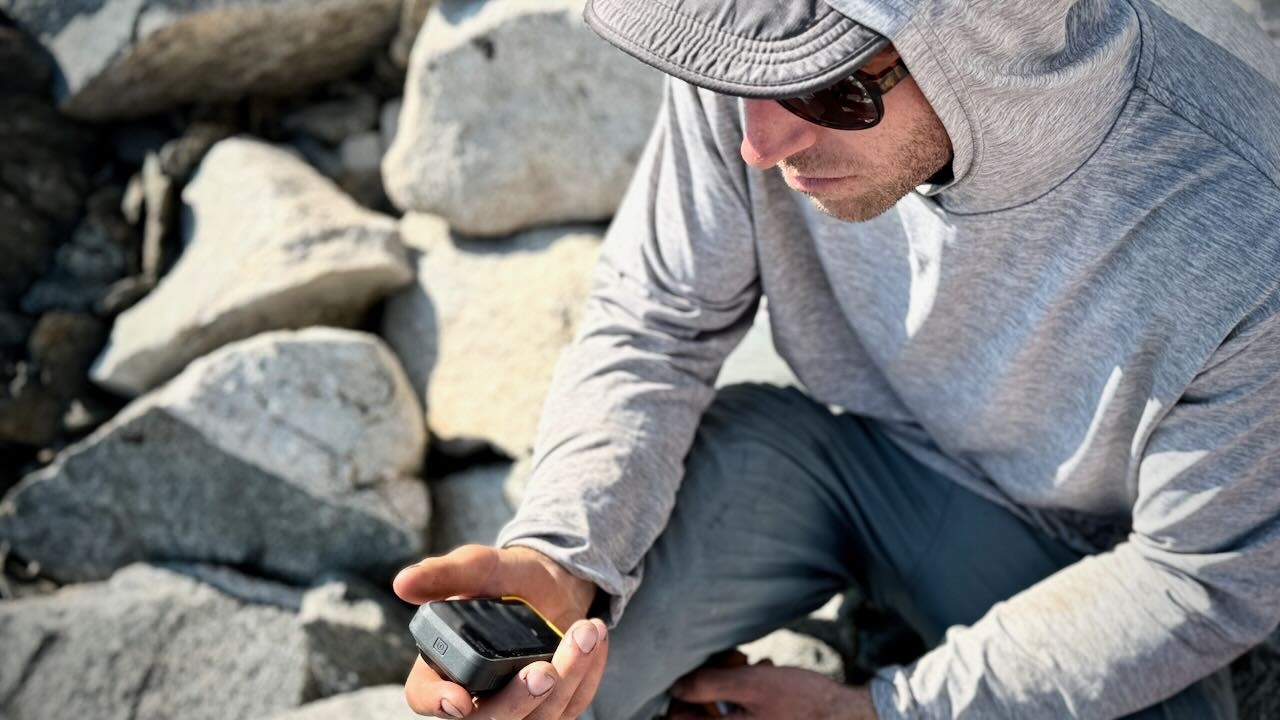
Some compact and lightweight GPS devices can even be stored on the strap of your backpack for easy access during travel.
Our testers evaluated everything from battery life to the navigation features and accuracy, to overall portability and versatility in order to determine the best application for each handheld device.
How to Choose Your Next Handheld GPS Device
Activity
So, who needs a handheld GPS? Those who love to hike off the main trail, serial bushwhackers, backcountry skiers, and climbers who frequently descend on unfamiliar and poorly marked trails. Adventurers of this breed will benefit the most from a GPS, which can pinpoint their exact location and allow them to re-orient themselves on a map and find the way home. A GPS is also helpful in bad weather conditions (heavy rain, snow, or fog) or when hiking on a dark, cloudy, or moonless night. It's also good when traveling over snow-covered terrain when the ordinary trail is buried, and the tracks of those who came before you may be unreliable (they might be just as lost as you — believe us, we've been there). Furthermore, if you're considering a handheld device with a modern touch screen that is better suited for negotiating backcountry two tracks in an ATV or an extended boating excursion off the coast, the overall portability isn't as much a consideration as the battery life when placed in expedition mode or the quality of the preloaded and downloaded maps. Whether pursuing extreme mountain or ocean sports, navigating your favorite two track, or tracking your next elk hunt, be sure to consider your specific needs based on your chosen activity, so as to match the technology of your GPS device with your preferences.
Backcountry skiers, serial peak baggers, and rock climbers often explore areas outside of cell reception and can benefit from the satellite accuracy and navigation to keep them on track, even help them to record it.
Credit: Michael O'Connor
GPS Device vs. Smartphone
What about the GPS on my smartphone? The reception of your smartphone may not prove as reliable while navigating deep in the backcountry. Smartphones rely on the combination of a cheap GPS device and triangulation between cell towers (and even WiFi) to dial in your location. Yet, many of the best hikes are in the mountains, deserts, or pristine backcountry areas with no reliable cell support, so your smartphone's GPS sensors might not cut the mustard.
Still, in situations where they do work, smartphone apps like Gaia, Avenza, or Topo Maps are great and can quickly identify your location on established trails before resuming map navigation. Smartphone GPS works best in a region where a cell signal is available, but it may become unreliable when you enter the backcountry. Don't forget to download maps before leaving cell or WiFi signals behind. A touchscreen model with automatic routing — like the Garmin Montana 700 — is a great option that can double as a driving GPS and for off-road travel.
In contrast to smartphones, handheld GPS units are burlier, with much better GPS satellite reception, more powerful navigation features, and supply better battery life in cold climates. A few questions will help narrow your search for the perfect handheld. After you figure that out, you can start thinking about all the bells and whistles — i.e., features.
Apple has also included an SOS feature with all models iPhone 14 or later that allows you to press an SOS button that connects you with emergency services via satellite. This feature can be used with or without cellular or wifi coverage, however, it functions best beneath open skies rather than densely treed forests and canyon bottoms. This SOS feature combined with a battery brick and a subscription to an app such as Gaia, CalTopo, etc. will likely make handheld GPS devices obsolete.
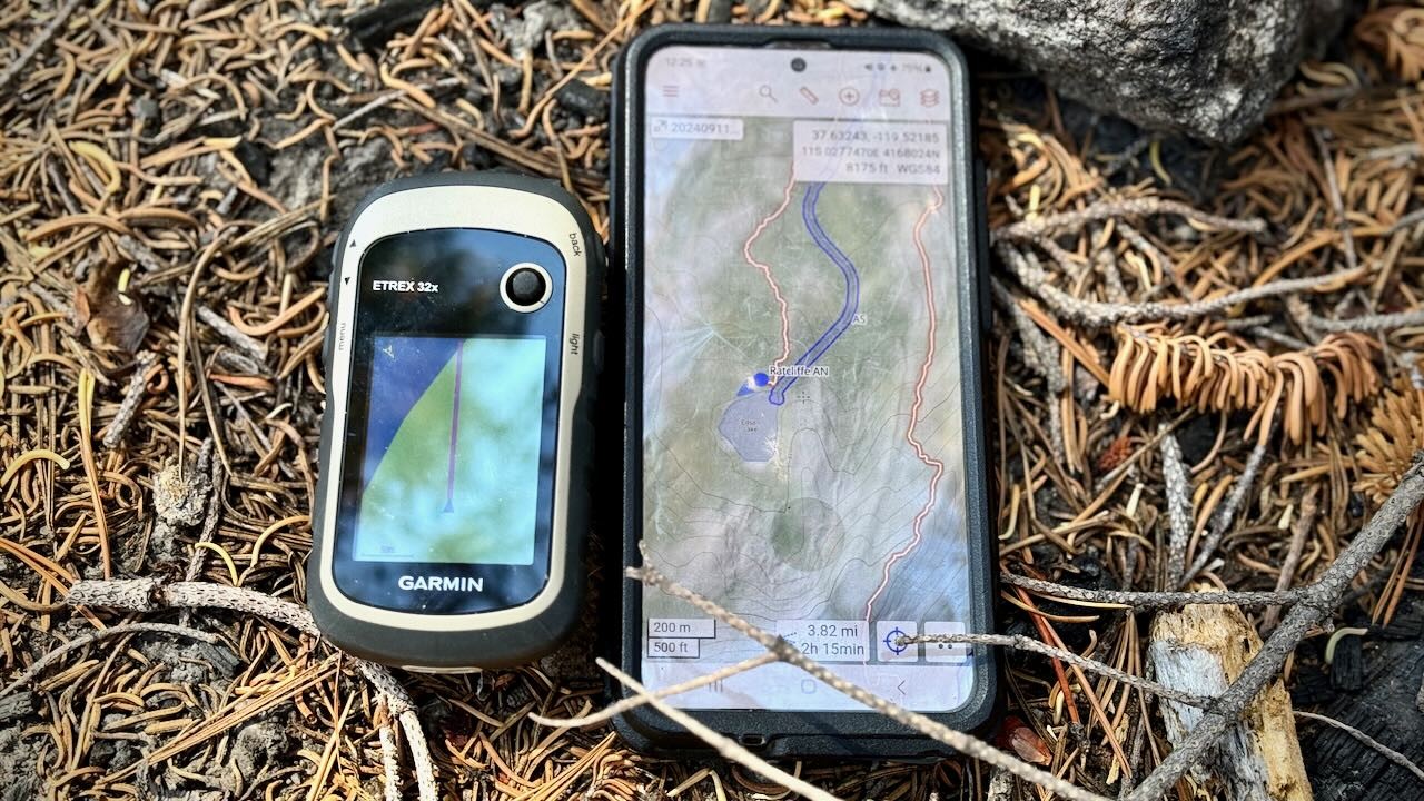
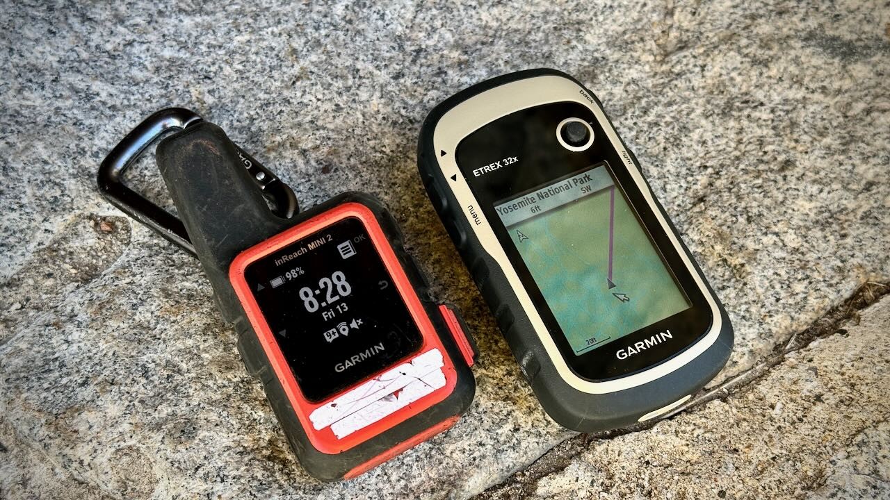
The eTrex 32x comes with pre-downloaded maps. This photo is a comparison between the Caltopo app and the basic Garmin map during an off-trail hike in Yosemite National Park.
Credit: Trish Matheny
Analysis and Test Results
We tested these handheld GPS devices over the years — climbing, hiking, skiing, mountaineering, canyoneering, kayaking, mountain biking, mapping plant populations, and more. We have marked and navigated to waypoints, compared map drawing speed, and tested the compasses of each unit against a trusty old, magnetic standby. We logged hundreds of miles on foot in California, Wyoming, Colorado, Washington, Utah, New Mexico, and Alaska. More than a dozen people — who range from GPS experts to complete novices — used these units to provide diverse feedback and bring you a review of some of the best handheld GPS units on the market.
We rated our selection of handheld GPS units on five scoring metrics: battery life, navigation performance, ease of use, portability, and versatility. It is important to note that these are some of the best and most popular options available on the market; while scores may vary, the numbers are based on how well each device compared to the competition. Some of these qualities are undeniably more important than others, namely battery life, navigation performance, and ease of use. Without the accuracy of a satellite and the efficiency of a GPS, you might as well be using a map and compass.
We break down the overall score into five key metrics:
Battery Life (25% of overall score weighting)
Navigation Performance (25% weighting)
Ease of Use (25% weighting)
Portability (15% weighting)
Versatility (10% weighting)
Off the grid backcountry in the Wind River Range was the perfect testing ground when considering battery life, navigation performance, ease of use, portability, and versatility.
Credit: Trish Matheny
What's the Best Value?
GPS stands for Global Positioning System. Often it's used to refer to devices — in this case, handheld — that can track and store timing and positional data. Though it may seem counterintuitive, they're often intended to be used with a traditional map and compass. They are designed to resist water, shock, thermal stress, and any other harsh conditions you'd typically run into out in the wilderness. High-performing devices come with extras like cameras, topo maps, better antennas, more memory, altimeters, barometers, internal electronic compasses, and most importantly an extended battery life. Baseline models are often light in weight, compact, and offer a great user interface that's easy to operate. Before buying your next handheld GPS, consider whether or not you actually need one, what activity you intend to use it for, and how much you're willing to spend. It is important to consider your specific needs before purchasing, as these units often carry a hefty price tag.
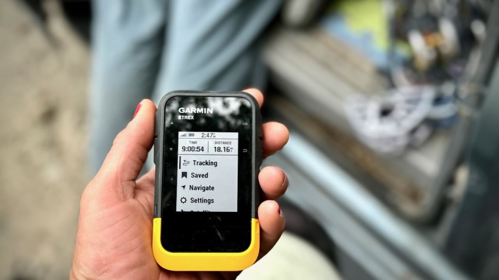
The price of a handheld GPS tends to be tied directly to its performance, features, and amount of memory storage. Options like the Garmin GPSMAP 67 and Montana 700 have almost every feature you could possibly need — with a substantial amount of memory and storage — however, both models are near the top of the price spectrum. Alternatively, the most affordable and entry-level model that we tested, the Garmin eTrex SE, provides a modern screen and a solid user interface. However, it lacks the ability to download and store maps.
Although not the best in terms of a feature rich design, the eTrex SE is a great option for those seeking a more modern, entry level device, that easily pairs with a smartphone and boasts a substantial battery life.
Credit: Trish Matheny
No GPS unit can substitute for basic orienteering skills, situational awareness, and common sense. They tell you where you are and where you've gone. In the unlikely event that you need to call for help, devices like the inReach Mini 2 offer an SOS feature that will send a signal with your precise location so that local Search and Rescue members can assist in the event of an emergency. It is important to note that this potentially life-saving SOS feature can only be accessed through payment of a Garmin monthly subscription. Furthermore, while we did not test any other options with the SOS feature and two way satellite communication, they are available for an increased price range. For example, if you like the sounds of the GPSMAP 67 but want the additional features of inReach technology, check out the GPSMAP 67i that provides the same burly design along with all the features, including inReach satellite technology. The inReach satellite technology is also available with other models in this review, just look for the “i” at the end of the device name. Another option to consider is a top-rated satellite messenger is what you want.
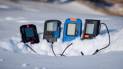
Battery Life
GPS devices typically boast a much longer battery life than that of a smartphone. While it is possible to operate most basic backcountry with an online mapping app and the ability to charge your smartphone through an external battery brick. Those who want to take their missions one step further, will appreciate the extended battery life (in addition to the more rugged and water resistant design) available in these handheld units. For this metric we tested each unit against their manufacturer claims while noting the battery saving tips and tricks to get the most out of your device.
Of the devices that charge via USB cable, these devices required anywhere from 2-3 hours to fully charge from a dead battery, while other devices, like the eTrex series simply require that you place 2 AA batteries into the unit before it is ready to go. Most of the devices that we tested fell in line with the advertised manufacturer's claims on their battery life. Most manufacturer's advertise both default GPS and expedition mode. Standard GPS mode does not include tracking as this is the easiest way to drain your battery in the field. We like to think of expedition mode as a beefier version of “low power” mode on your smart phone, which dims the screen and limits feature so as to better preserve battery life. Perhaps the most impressive in terms of overall battery life is the eTrex SE that boasts 168 hours in basic GPS mode and up to 1,800 hours in expedition mode. We must admit that these numbers could vary based on the specific use and configuration of your device as well as the batteries that you choose to stock it with.
The eTrex SE has phenomenal battery life, minimally impacted after three hours of tracking,
Credit: Trish Matheny
Other devices that boast impressive battery life are the GPSMAP 67 with 180 hours in GPS Mode and up 840 hours in expedition mode. When testing these manufacturer claims, we were able to achieve about 7 days of battery life strictly in GPS mode without tracking and roughly 30 days of battery life when set to expedition mode. To be fair, these measurements were taken at 9,000 feet at the cusp of fall, the GPSMAP 67 was exposed to cold nights (20F) at an elevation of about 8,500 feet in Tuolumne Meadows, Yosemite National Park.
Some devices, like the GPSMAP 67, make it easy to select “expedition mode” for additional battery savings.
Credit: Trish Matheny
The inReach Mini 2 was another impressive device with an extended battery life. Our testing team achieved roughly 650 hours of battery use in open sky while sending messages and tracking very minimally. The device didn't work as well in treed canopies as it was draining the battery while constantly searching for a satellite signal. While tracking an ascent of the 13,726 foot Bear Creek Spire in the High Sierras, our team utilized about 19% of the battery life to record our progress car to car. Afterwards, we turned off the device and it held onto that remaining 81% for 6 weeks inside our tent cabin, exposed to colder temperatures.
The Garmin inReach Mini 2 used about 10% of the fully charge battery while tracking from trailhead to summit for a total of 4 hours. Tracking is one of the fastest ways to drain a fully charged GPS unit.
Credit: Gus Landefeld
All of the devices that we tested suggest various battery saving modes and features to preserve the overall life of your unit's battery. Of these tips and tricks, setting the device to expedition mode is the easiest. It limits the number of tracks recorded in addition to automatically removing access to Bluetooth, etc. The only device that does not feature expedition mode is the eTrex 32x. The most helpful battery savings techniques that we found outside of expedition mode included, dimming the screen, simply turning off unless messaging, using in open canopy versus a densely treed forest or tight slot canyon, utilize the lock button feature, turning off Bluetooth or wireless connectivity manually, and limiting the number of satellites that you are accessing for a more accurate and precise location.
Although the eTrex 32x is the only unit that we tested that doesn't offer an “expedition mode,” there are multiple ways to preserve the battery life.
Credit: Trish Matheny
Navigation Performance
Most modern GPS units are incredibly accurate and can pinpoint the device's location to a resolution within 10 meters. According to Garmin, units that use the Wide Area Augmentation System (WAAS) can be accurate within 3 meters or less. All the devices we tested use WAAS. To get even more accuracy, you can buy a differential beacon receiver and antenna to utilize a distance correcting Differential GPS (DGPS). For comparison, modern smartphones offer GPS accuracy of around 4.9 meters, according to GPS.gov.
Tall buildings, canyons, and trees can interrupt satellite signals, slowing them down and reducing your device's accuracy. Clouds and weather, however, shouldn't affect reception. To get the best signal with the satellites, carrying your device outside your pack or in a light waterproof layer is best.
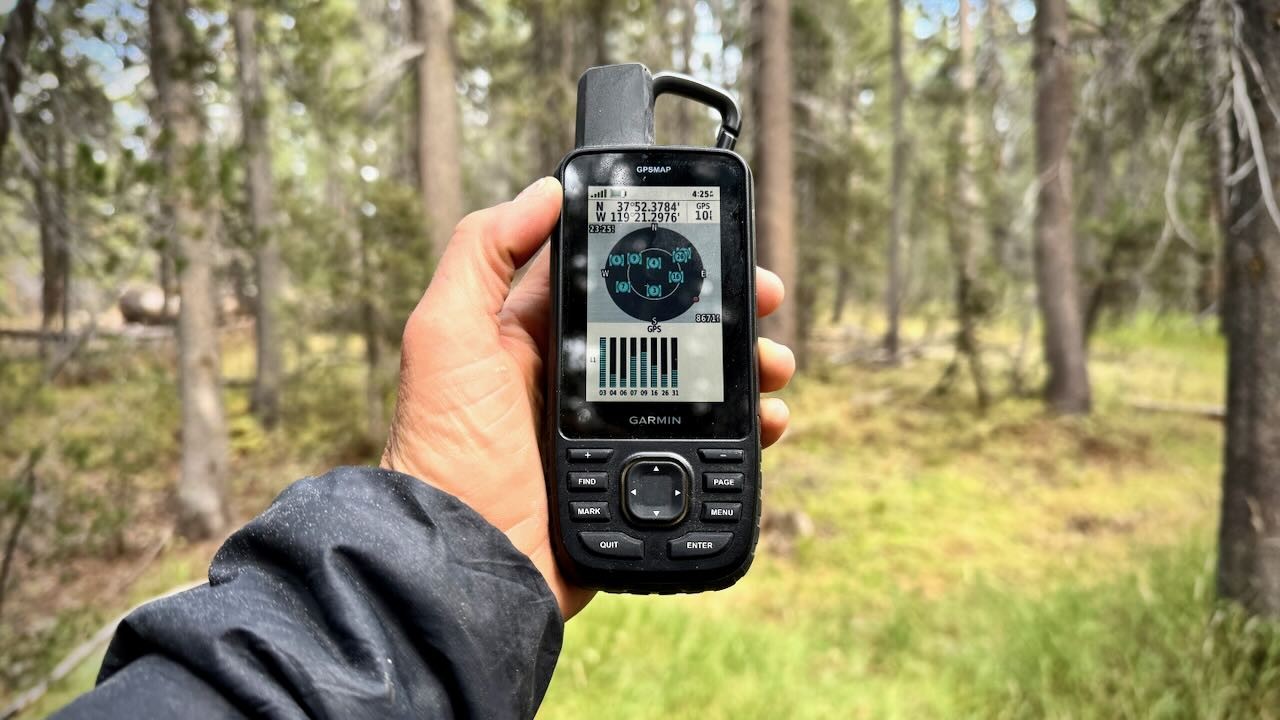
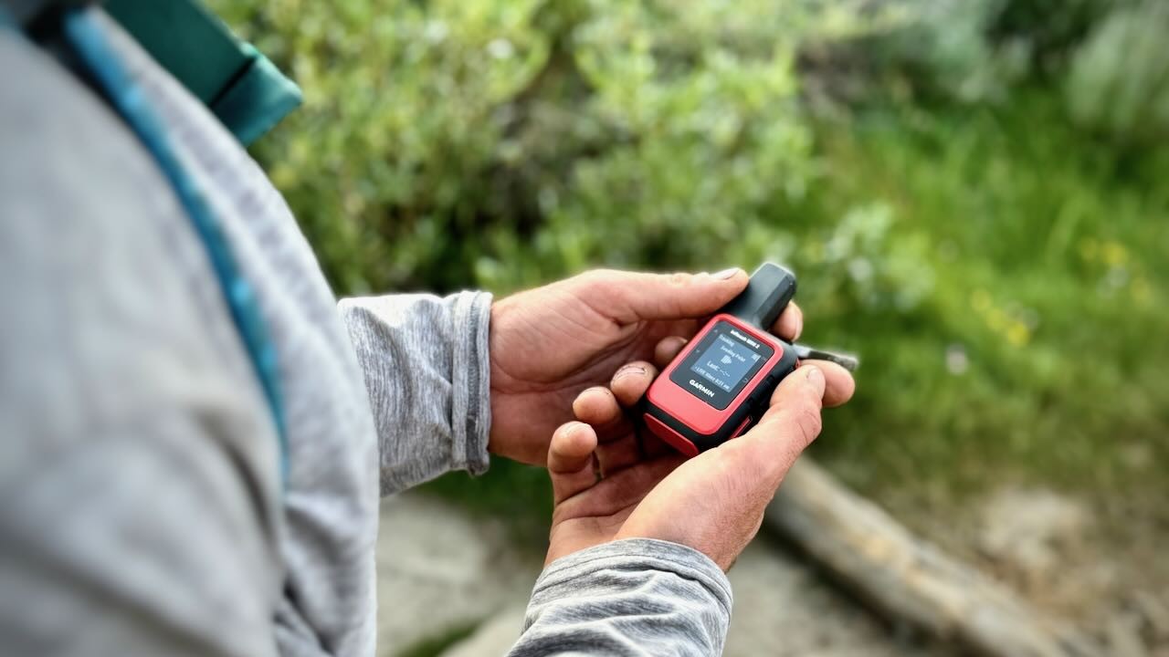
Clipping the GPS device to the exterior of your pack allows for better connection and easy access to monitor progress, mark waypoints, etc.
Credit: Trish Matheny
GPS units communicate with satellites orbiting the Earth that are designed to read and triangulate signals sent from the unit. The Department of Defense manages the GPS network in the United States, a series of 33+ satellites that transmit both positional and timing data. When a GPS unit contacts at least four satellites, it can pinpoint your position accurately, although terrain and conditions can certainly affect this feature. Some of the units we tested can also interface with other countries' satellites, including the 26 satellites of the Russian GLONASS system or 26 more from the European Union's Galileo network. The more satellites, the faster and more accurately you can identify your position. All handhelds use the WAAS (Wide Area Augmentation System) to increase accuracy. Satellites send signals to WAAS master stations on the ground. This message is relayed to compatible receivers (like GPS units) to provide a much more accurate location estimate. GPS units that use GLONASS, GPS, Galileo, and WAAS will offer the best reception.
Although a more affordable option, the eTrex SE, gathers information and positioning from GPS, GLONASS, Galileo, BeiDou and QZSS satellites that allows the device to supply more accuracy and efficiency while tracking through off the grid, mountainous locations.
Credit: Trish Matheny
Our testers found that the highest performing — but unfortunately, also often the most expensive — models tend to achieve the best satellite reception. Units like the GPSMAP 67 include a quad-helix antennae, which are quite sensitive even beneath dense coverage. The GPSMAP 67 was the fastest and most accurate unit we tested, as that is the only unit that could access all three satellite networks and improve its signal with WAAS. Although the Montana 700 was nearly as speedy as the GPSMAP 67, even basic units like the eTrex SE impressed us with how quickly they could lock onto a signal after powering on.
Utilizing the greatest number of satellites (GPS, GLONASS, Galileo, BeiDou, IRNSS, and QZSS), ensure the accuracy of the GPSMAP 67.
Credit: Trish Matheny
Electronic compasses — as opposed to a mechanical, differential compass — also improve accuracy when on the move and are included in expensive units like the Montana 700, but surprisingly in more affordable units like the eTrex 32x and inReach Mini 2. Even without these additions, however, all of the Garmin units we tested provided quality reception. All of the units that we tested (with the exception of the inReach Mini 2) carry receivers that accept both GPS and GLONASS satellites, so even price-point models — like the eTrex SE — offer nearly top-notch reception and accuracy in almost every situation. The inReach Mini 2 utilizes the Galileo and QZSS satellite systems.
Each unit that we tested for this review features an electronic compass.
Credit: Trish Matheny
Ease of Use
When our testers considered overall ease of use, we started with the user interface, whether or not the setup was intuitive, how quickly the devices could connect and download maps from other sources, as well as many many more details. It's important to think about where you will be going with your device and what it'll need to do for you. The map available to your device for tracking your movements is critically important as is the display screen that you will be viewing this information on. These maps will determine the quality of the navigation assistance you receive as well as make it easier for emergency services to reach you in the event of any emergency encountered in the field.
Some GPS units come with just a rudimentary base map that distinguishes primary cities, roads, and landmarks within the regional area of purchase (in our case, the U.S.) but not much else. Of all the devices we tested, only the relatively inexpensive eTrex SE, which sells for half the cost of the next lowest price product in the lineup, the eTrex 32x, falls into this category. Its entry level design lacks the more advanced preloaded TopoActive maps you find upgraded models such as the GPSMAP 67 or Montana 700, and doesn't even offer the option to purchase such maps via a subscription like Garmin Explore. This limitation could be a considerable deterrent to some shoppers and a reason to consider spending a bit more to get exactly what you need.
Many higher-priced models come out of the box with preloaded maps like Garmin TopoActive, and/or such maps can be easily purchased and uploaded once they are in hand. It is also possible with some devices to download maps and satellite imagery online for free, downloading selections to your personal computer before then transferring those maps directly to your specific GPS device for use. The Montana 700 and GPSMAP 67 models make this easy, and websites like the United States Geological Survey offer a wealth of free spatial data. Similarly, most states in the US also have to distribute spatial data at no cost. If you want the best maps, often for free, we recommend you further explore the range of data and mapping options available online. If you want more convenient, straightforward map access to save on time, you can get them for around a hundred bucks from your GPS manufacturer.
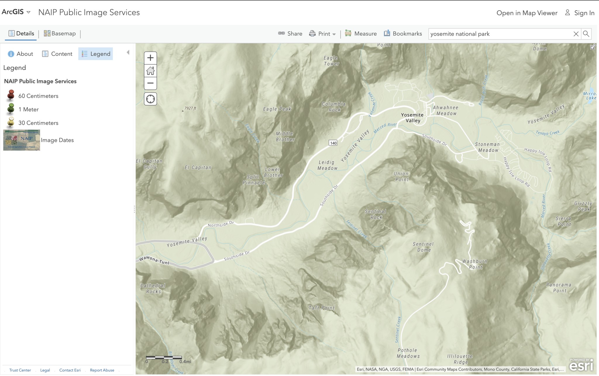
The quality of satellite imagery is very important for handheld GPS devices as clear and detailed images more quickly provide an accurate location. The US National Agricultural Imagery Program (NAIP) shoots high-quality, free satellite imagery (aerial photos stitched together) for the entire continental United States. You can also buy satellite imagery. Often this is unnecessary because you can plan your routes in Google Earth and then send files to your mapping software and device. Satellite imagery is hard to see on most GPS units and is rarely necessary for the backcountry. GPS units, like the GPSMAP 67, come with a free subscription to Garmin's database of Birdseye satellite imagery that can be downloaded on WiFi. The inReach mini 2 and the eTrex SE do not have access to this option.
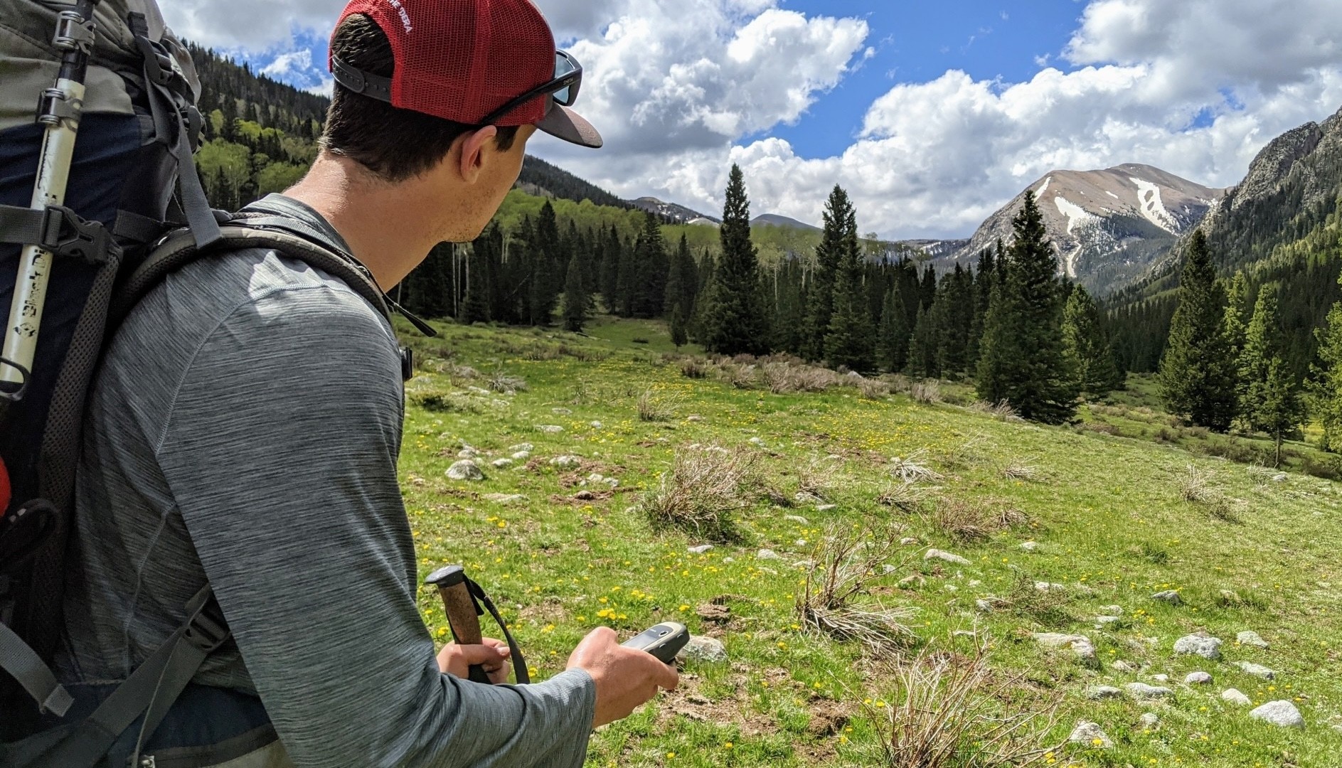
Not everyone knows where their adventures will take them when they leave home, so for some, having a device that can download a host of maps and trace movement using waypoints along the way can be a critical feature to keep an eye out for.
Credit: Steve Mace
It is also possible to access maps through the Garmin Explore app subscription. This free application offers software designed to organize, analyze, and display the waypoints (a location that can be saved and accessed later for navigation and/or reference). The Garmin Explore app can be downloaded to your home laptop or smartphone before syncing to your GPS device to utilize the features at home or in the field. It also records the tracks you collect with your GPS. It's a simple and intuitive cross-platform that provides everything a basic GPS user needs. For example, you can easily see waypoints or tracks on your smartphone or computer screen via Google Earth. We recommend viewing your proposed route on your computer before entering the backcountry and trying to access the information for the first time on the small screen. On really basic models like the eTrex SE, an additional app like Garmin Explore is essential for use due to the device's lack of preloaded maps and upload capability, as without it, the GPS unit would otherwise be rendered somewhat useless. It has the ability to track the waypoints but on a very basic level.
Each device that we tested has the ability to track waypoints with or without the Garmin Explore app. You can essentially mark a waypoint at your current location or mark a waypoint by entering coordinates, and then the GPS device can be used to navigate toward that marked waypoint. Devices like the eTrex SE are non-mapping devices that can be used in conjunction with the Garmin Explore app, which can then group marked waypoints, geocaches, activities, etc., into a data collection that can be synced between the unit and the app for navigation in the field.
The “saved tracks” represent a collection of tracks that connect in order to record your route, while the points per track are indicative of the number of location markers or points per track that essentially create your track. As you can see, devices like the Montana 700 and GPSMAP 67 offer the most tracks and points per track, while devices like the inReach Mini 2 offer the least.
The NAIP offers shoots high-quality satellite imagery for the entire continental United States that doesn't require a subscription for access.
Credit: Trish Matheny
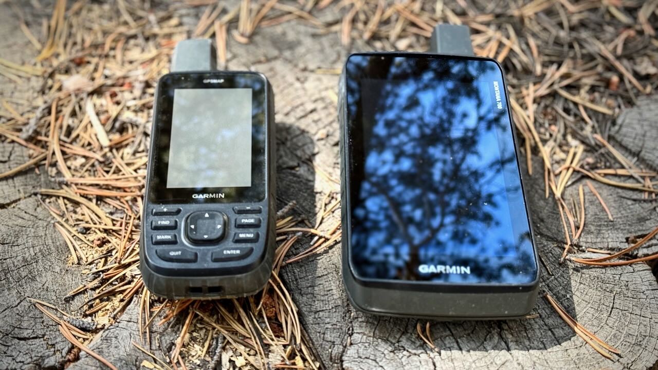
Another important facet to consider when purchasing your next GPS device is the display screen, which can be a key factor for ease of use and can run the gamut from micro-sized at less than an inch squared (InReach Mini 2), to smartphone size at nearly four-and-a-half inches by two-and-a-half (Montana 700). Are you after a compact version like the 5.6 ounce eTrex 32x with a screen that's less than two inches squared, or are you willing to haul extra weight for perks like the 14-ounce Montana 700 provides, with its larger, easy-to-use, modern touchscreen design? Is a big GPS screen more important because you would like to quickly see information at a glance while driving? Or are you willing to squint for a more portable unit? Since all of the units in this review are handheld, none are huge — but there is a difference in screen size and display quality among them.
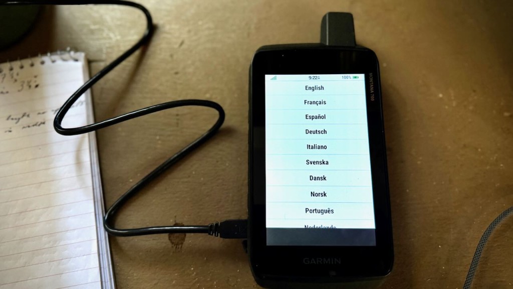
For example, the Montana 700, with a 5-inch diagonal screen, offers the largest screen and the highest quality resolution (480 x 800 pixels). Its smartphone-like touchscreen makes navigation easy, particularly in a vehicle. Touchscreens also have a faster response time than button units. The GPSMAP 67 claims the next largest screen size we saw in our lineup at 3 inches diagonal, nearly half the size and more than adequate in terms of resolution (240 x 400 pixels) for a handheld unit. However, it is much more cumbersome to operate in hand due to the small button controls instead of a touchscreen. This interface is a bit like stepping back in time, reminiscent of the cell phones in the early aughts, and it is particularly challenging for anyone who has grown accustomed to modern touchscreen and zooming technology. Of the smaller and more basic options that we tested, the eTrex 32x features a color screen, although the monochrome display screens of the inReach Mini 2 and eTrex SE almost feel more modern and user-friendly.
The Montana 700 is the only device that we tested that features a modern touch screen with the ability to zoom in a similar manner to a modern smartphone.
Credit: Trish Matheny
The GPSMAP 67 has a 3.75 square-inch screen — nearly half the size — but more than adequate in terms of resolution (240 x 400 pixels) for a handheld unit. However, it is controlled by buttons instead of a touchscreen, and this interface is a bit like stepping back in time, especially for those who have grown accustomed to modern touchscreen and zooming technology. Of the smaller and more basic options that we tested, the eTrex 32x features a color screen, although the monochrome display screens of the inReach Mini and eTrex SE almost feel more modern and user-friendly.
As much as we appreciate the user-friendly nature of a touchscreen, it's important to note the downsides: the feature eats up battery life much faster than alternatives, can potentially freeze in cold climates, and isn't the most compatible with thick gloves. And, in most cases, touchscreen GPS units aren't nearly as advanced in their design and function as smartphones. For example, the Montana 700's battery can only offer 18 hours of life in standard GPS mode, compared with the 180 hours you might enjoy with the GPSMAP 67 or up to 336 you would get with the InReach Mini 2 (depending on the configuration and use). In Expedition Mode, you can expect to enjoy even more - button models will deliver up to double or even triple the number of hours available with the touchscreen Montana 700. Super basic button devices like the eTrex SE can deliver as much as 1800 hours on a single charge when set to Expedition Mode. So, it really comes down to personal needs and preferences when weighing these trade-offs.
The inReach Mini 2 and eTrex 32x feature smaller screens, the Mini screen is monochrome and the 32x is a color screen, however, both feel like stepping back in time when compared to modern smartphone technology.
Credit: Trish Matheny
Portability
We tested handheld GPS units. These units are capable of marking waypoints, tracking your route, making notes, geocaching, pulling altitude profiles, and so much more. Some are even small enough to wear around your neck, stash inside your pants pocket or on the top of your backpack, or even clip to the shoulder or waist strap of your backpack. When it comes to off-the-grid navigation, handheld devices are becoming more and more popular among backcountry enthusiasts, particularly because they are so compact, lightweight, and portable. It is often the case that the most baseline devices offer the lightest design, however, the more features that you add into a portable GPS unit design, the larger and heavier they become. This is a simple and objective testing metric, our team simply weighed and measured each device, before recording the measurements of each display screen.
Not all units are created equal when it comes to overall portability, so it is important to consider whether you'll carry your GPS in your pocket or plan to stash it in a backpack. The Montana 700 is by far the largest and heaviest unit in our review. The 700 weighs in at 14 ounces and measures 7 1/2 x 3 1/4 inches, about the same length as our iPhone 15, just double the width. Devices like the eTrex line fall at the other end of the spectrum — both the eTrex SE and more capable eTrex 32x are small enough to fit into a pant's pocket.
The Montana 700 is about the same length as a modern smartphone, however, it is double the weight and overall width.
Credit: Trish Matheny
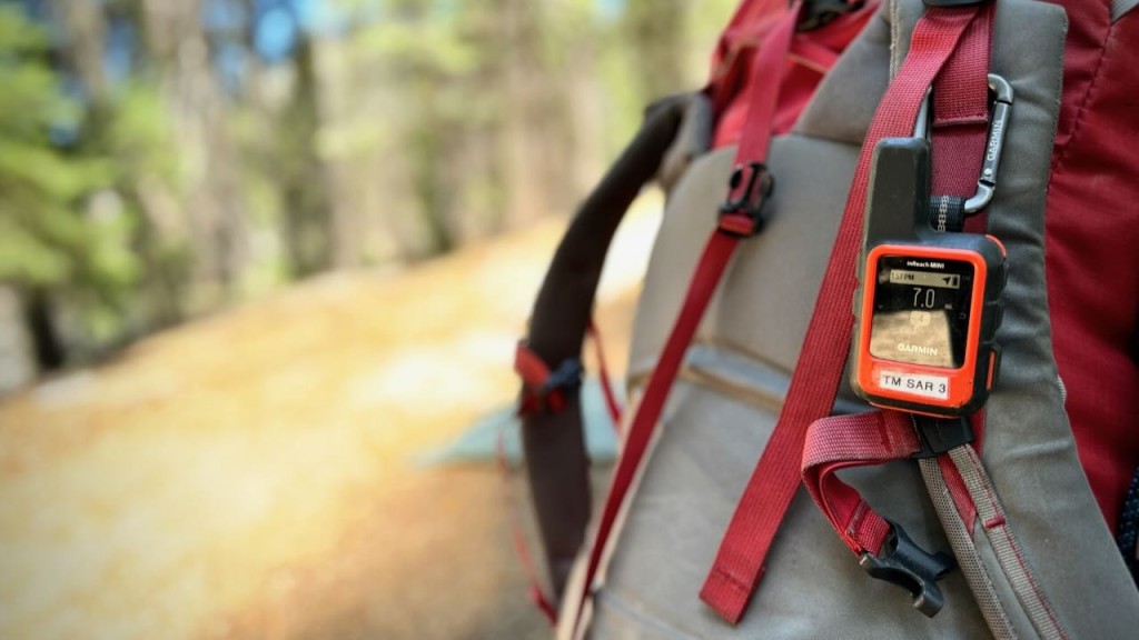
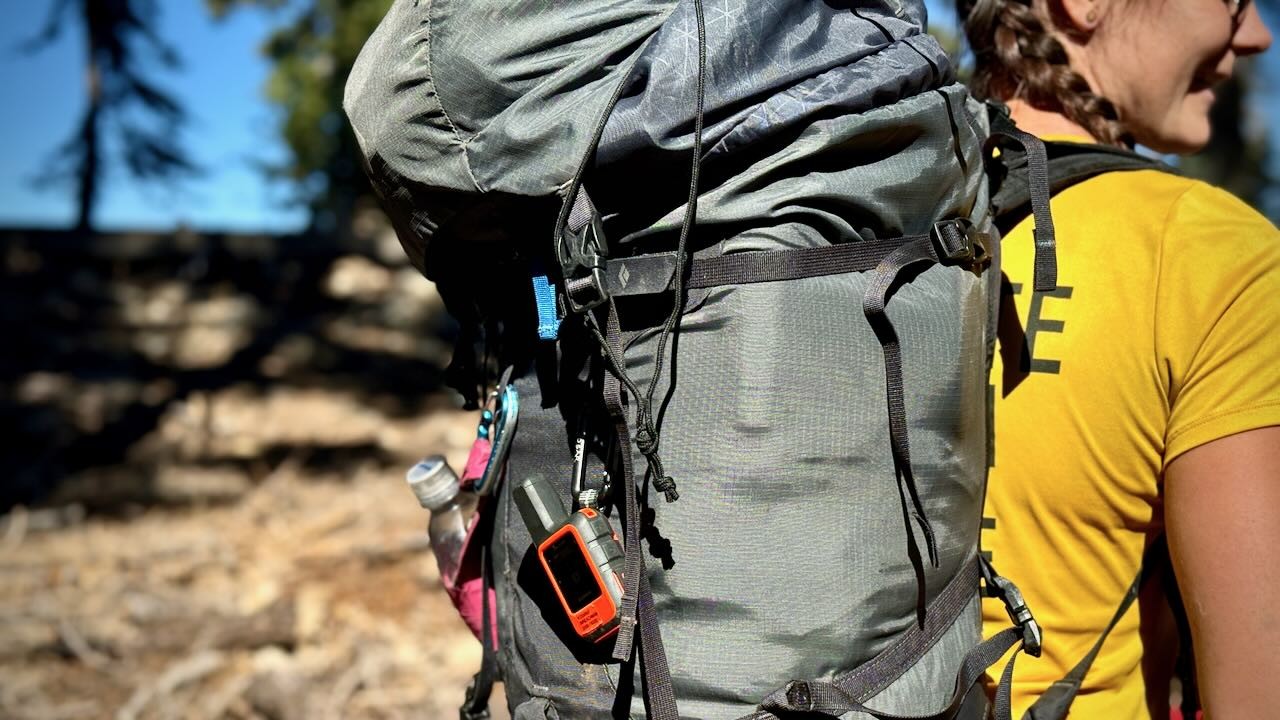
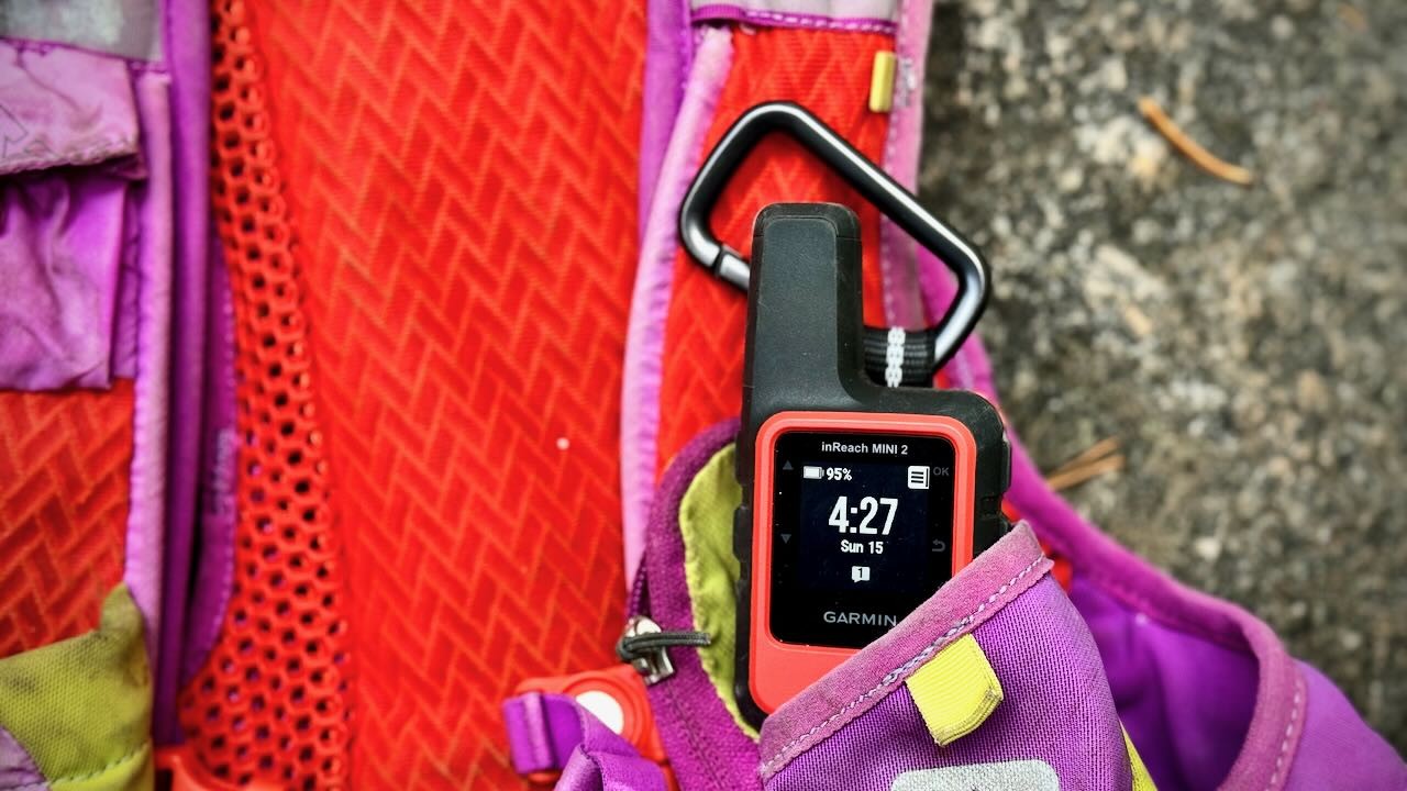
If you're after the smallest and lightest GPS unit that we tested for this review, check out the inReach Mini 2. This small unit weighs only 3.5 ounces, however, the tradeoff is also the smallest display screen that measures roughly 1 x 1 inches. While this device is perfect for those seeking to track activities, check in with loved ones out of service, or deploy the SOS function in case of emergency, it is limited when compared to other feature-rich designs that we tested for this review. Due to its compact size and lightweight, our lead tester had no issue tossing it into her running pack when pursuing 50+ backcountry miles in a single day. Though every item of nutrition, hydration, and emergency layering was considered so as to limit weight, the Mini 2 required very minimal space inside the small pack. Not only did the SOS feature and satellite communication provide peace of mind to our tester, but also peace of mind for those who were her emergency contacts, making sure that she completed the solo ultra-marathon through the High Sierras.
3.5 ounces is nothing when you consider the peace of mind provided by the Garmin inReach Mini 2.
Credit: Trish Matheny
Just as a point of comparison, there is also a variety of GPS Watches that can log backcountry travel information. These are popular among trail runners, mountain guides, hikers, and backpackers. They are a great alternative to handheld units if you're looking to go light but have a much shorter battery life and a significantly smaller display. They may not offer the same capabilities as the handheld units featured here.
GPS watches are another great consideration for those looking to save weight while navigating the backcountry.
Credit: Matthew Richardson
Versatility
Most units we reviewed are astonishingly versatile; sporting functions well outside navigation, ranging from flashlight to calculator to texting. For this metric, we considered everything from compatible apps, how well they functioned in and out of service, the best application for the various features, whether or not the device was waterproof, could be operated with gloves on during inclement weather, as well as the storage available within each unit. Most of the GPS units can be operated with gloves on during cold weather pursuits such as backcountry skiing, thanks to the push buttons and a somewhat dated user interface similar to an analog phone. The only exception here is the Montana 700, which supplies the most modern interface with touchscreen technology. We won't dive too deeply into each and every function available within each device that we tested. Rather, we will discuss a few of the most important ones to help guide you.
Waypoints
You don't need that many waypoints to get you through most backcountry trips, even if it's a pretty extended adventure. Even 500 waypoints is likely more than most people would need at any given time. These waypoints are also very easy to save on your computer and then delete once you're back at home. If you plan on compiling waypoints that were documented during multiple trips, conducting detailed science surveys, or embarking on a mapping mission, aim high. The waypoints available on the units that we tested ranged anywhere from 1,000 to 10,000. The Montana 700 and GPSMAP 67 offer 10,000 waypoints each, while more affordable units like the eTrex SE supply only 1,000. For many of these units, you can also boost your memory with a microSD card. That being said, the inReach Mini 2 and the eTrex SE are not compatible with a microSD card, and the SE features very limited internal memory storage at a mere 28MB. The SE is best operated alongside apps like the Garmin Explore app.
Marking a waypoint is a great way to remember that special campsite you found in the backcountry.
Credit: Trish Matheny
Geocaching
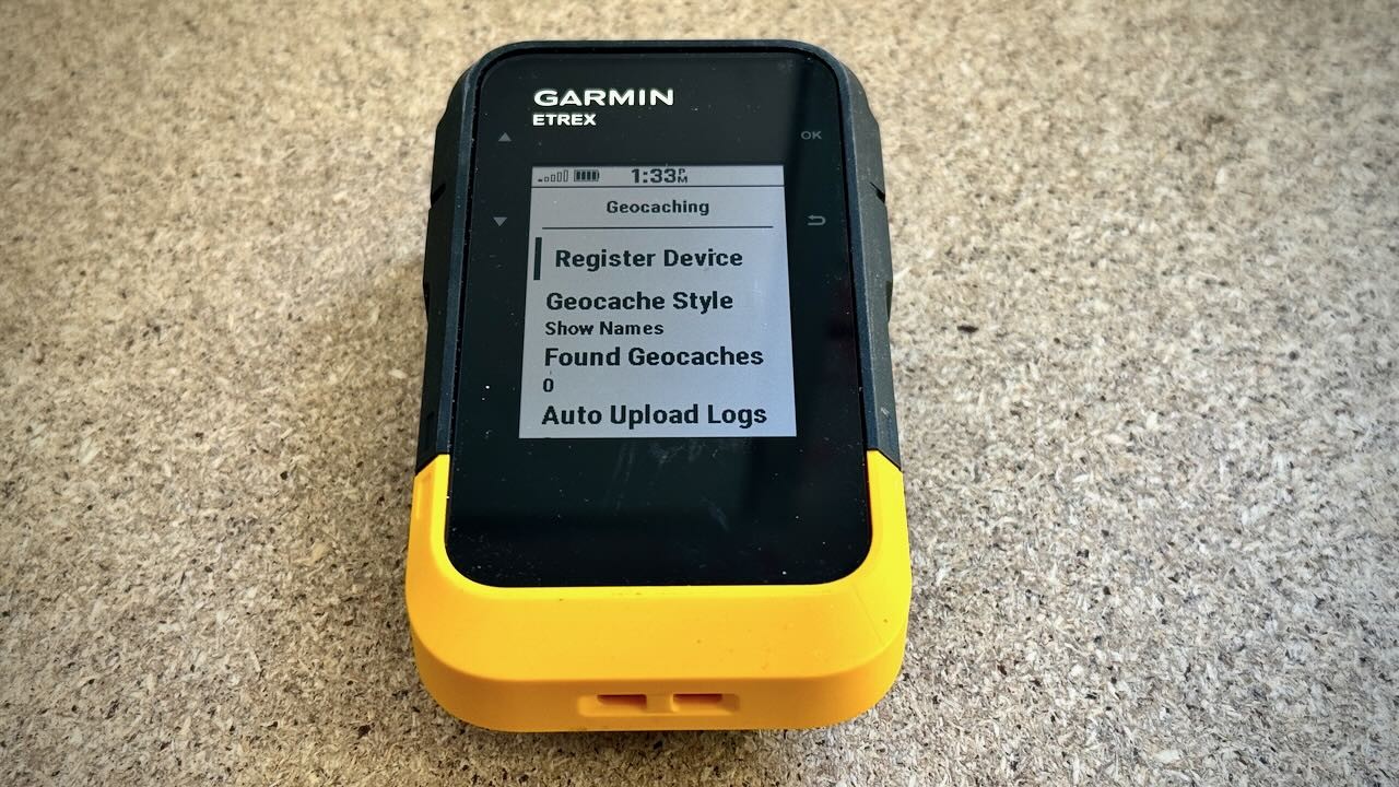
Geocaching is a relatively new outdoor activity, essentially using a GPS unit or GPS software for a scavenger hunt, looking for hidden treasures all over the world. Most GPS units are set up for this somehow, and some of the ones we tested have preloaded geocaches so you can unpack and play. All of the units that we tested are setup for geocaching, with the exception of the inReach Mini 2. A huge draw for the geocaching crowd is that a modern GPS unit — with text display — allows them to go paperless. For those seeking an entry-level option that allows access to this worldwide phenomenon, the Garmin eTrex SE is a solid consideration, thanks to its accuracy and battery life, that's available for a more affordable price.
The eTrex SE is the perfect companion for those seeking an entry level device to begin a geocaching adventure. Simply register your device and you're good to go.
Credit: Trish Matheny
Electronic vs. Differential Compass
The cut-off point between basic units and those that are more sophisticated is usually an electronic compass. This allows a unit to display your heading while held in place. In contrast, you have to be moving for a differential compass to work properly. For some, this is a great advantage — say, during a whiteout next to a cliff edge. Many mountain guides prefer an electronic compass because it makes navigating faster and easier. All of the handheld GPS devices that we tested for this review supply an electronic compass.
The speed and accuracy of an electronic compass is much preferred, each unit tested for this review offers an electronic compass feature.
Credit: Trish Matheny
Barometric Altimeter
Another feature that separates high-performing devices from base models is a barometric altimeter, which uses a small sensor to detect air pressure and calculate altitude instead of relying on positional data alone. Barometric altimeters also allow you to track weather patterns and trends, which can be useful in the mountains when knowledge of an incoming storm is crucial. All of the GPS devices that we tested for this review supply a barometric altimeter, except for the inReach Mini 2.
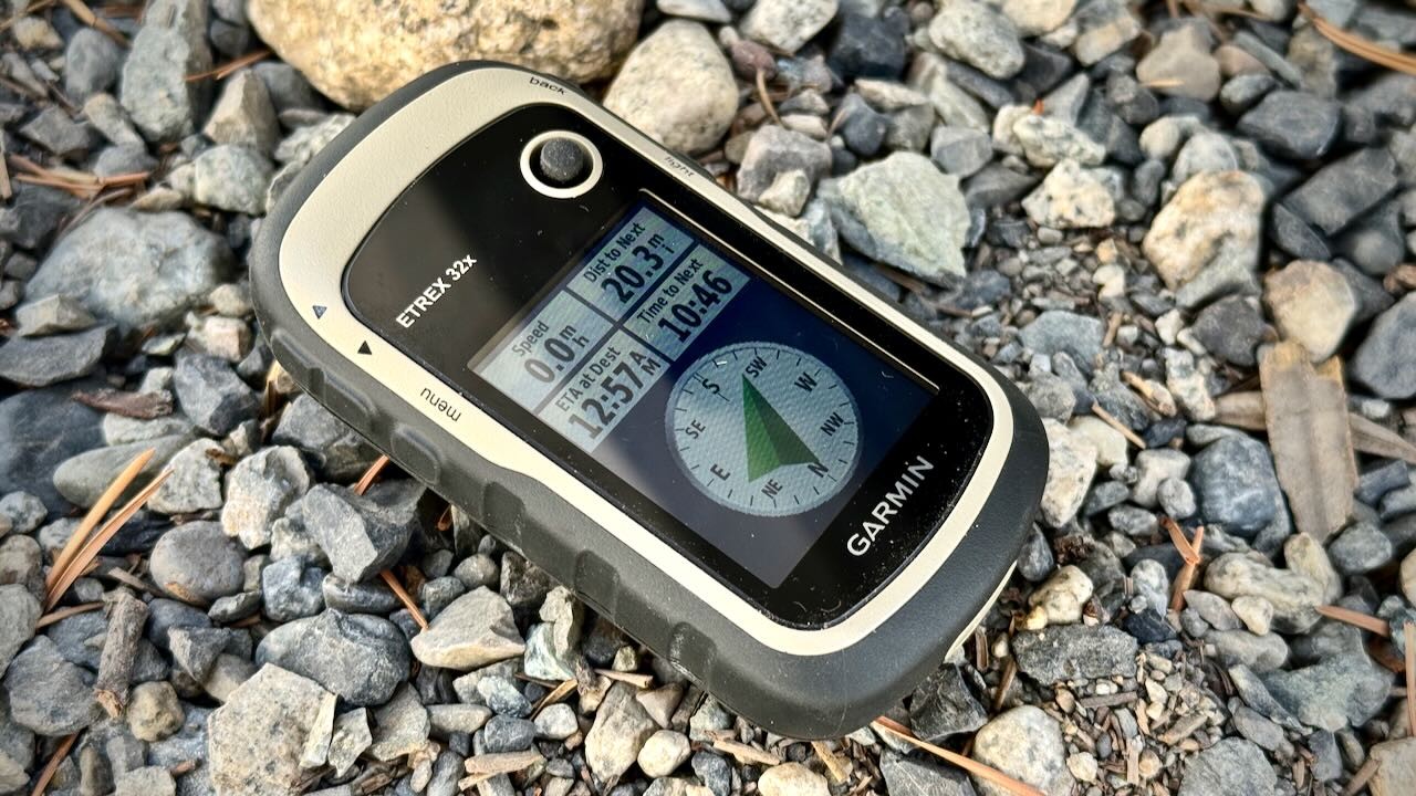
The eTrex 32x is the only price-point model that also includes a barometric altimeter, which comes in handy when accurately assessing large changes in topography.
Credit: Jill Rice
Wireless Capability and Smart Notifications
High-performing GPS devices are able to share wirelessly — these devices come equipped with Wifi, Bluetooth, and ANT+ technology. A compatible receiver can quickly send track and waypoint files to another device wire-free. One member of our testing team noted that this feature is especially helpful if you have another group that is about to embark on the same route you just completed. Prior to the second group's departure, it is possible to sync the devices and share your route in a matter of minutes. We highly recommend investing in a device with wireless capability and smart notification for those user groups intending to share track information with others in the field.
Another great feature is smart notifications. You can sync your smartphone to your GPS and receive text messages or social media updates on the unit. High-end units like the GPSMAP 67 sport this high level of technicality, but it does take some time and know-how to set up. This may be an option if you don't want to take your phone out of the backpack while staying connected. Wifi, Bluetooth, and ANT+ have become commonplace in most of the GPS devices that are available today. ANT+ is a protocol that allows devices to wirelessly transmit data from one device to another. This is a nice option for those seeking to transfer data gained in the field to another device that has a greater option for storage or for outdoor enthusiasts who seek to transfer fitness marks such as weight scales, pedometers, heart rate, etc. Of the devices that we tested, each device has ANT+ compatibility except for the eTrex SE that is only compatible with bluetooth. The Montana 700 and the GPSMAP 67 are the only units that are compatible with all three wireless options. The inReach Mini 2 offers Bluetooth and ANT+, while the eTrex 32x is equipped with ANT+.
The GPSMAP 67 and Montana 700 are the only devices (that we tested) that are compatible with bluetooth, wifi, and ANT+.
Credit: Trish Matheny
The Garmin Explore app is a great companion for most of the devices that we tested for this review. All devices except for the eTrex 32x can be utilized alongside the Garmin Explore app, which essentially offers a detailed topographic map on your smartphone that allows you to map, track, and share your data while off the grid. While you can download the app for free, some options require a subscription. The Garmin Connect app is also free to use and doesn't require a monthly subscription. Garmin Connect is a fitness-focused app that allows users to track workouts, health stats, and activities, sync data with other apps, and display data to encourage friends. The Montana 700 and GPSMAP 67 are compatible with the Garmin Connect app.
The Garmin Explore App is free to download and makes a great companion for your GPS device, especially if the screen is small and the interface is less modern than current smart phone technology.
Credit: Trish Matheny
Conclusion
GPS units can be an essential backcountry tool for those adventurers who prioritize off the grid navigation and communication, however, they are quite an investment. For most backcountry enthusiasts, a smartphone and a free mapping app can certainly get the job done, especially for those with newer smart phone technology that also supplies the crucial SOS feature should something unexpected occur during your adventure. For those who are planning a multi-day trip in the backcountry (especially novices) that are primarily guided by a paper map and compass, scouting multiple complicated routes off trail, or conducting long field surveys, a GPS unit can be incredibly helpful. If you are going that deep in your explorations, you might as well consider investing in the overall accuracy and battery life offered by a dedicated handheld GPS unit.
Our testing team hopes this review is helpful when purchasing a GPS device for your next backcountry adventure.
Credit: Trish Matheny
—
Chris McNamara, Jediah Porter, Aaron Rice & Trish Matheny