Garmin GPSMAP 66st Review
Our Verdict
Compare to Similar Products
![]() This Product
Garmin GPSMAP 66st | |||||
---|---|---|---|---|---|
Awards | ![]() | ![]() | |||
Price | $450 List | $550 List | $270.09 at Amazon Compare at 2 sellers | $110 List $99.01 at Amazon | $300 List |
Overall Score ![]() |
|||||
Star Rating | |||||
Pros | Excellent reception, large buttons, big screen, smart notifications and connectivity | Straight-forward touchscreen interface, preloaded topo maps, camera for easy geo-tagging and sharing | Reasonably priced, includes barometric altimeter and electronic compass, small and lightweight, long battery life | Low-cost, miniature-sized, reliable durability, accurate | Lightest touchscreen, Responsive, Preloaded with Geocaches, Bluetooth connectivity, Intuitive touchscreen controls |
Cons | Expensive, bulky, complicated connectivity between devices | Touchscreen performance when wet, potential battery issues, expensive | Small screen, lack of connectivity, tedious user interface | Nearly non-existent basemap, lack of mapping capability, insufficient internal memory | Minimal base maps, Battery life shorter than some, No preloaded topos, |
Bottom Line | Our favorite model, this reliable and accurate GPS unit is full of features | This touchscreen unit strikes a nice balance between straightforward functionality and high-end capabilities | The addition of an altimeter and electronic compass make this lightweight unit one of the most cost-effective options on the market | Perfect for geocaching or tracking your next adventure, but not designed with mapping in mind | The Garmin eTrex Touch 35 introduces a nice touch screen and features to the lightweight eTrex line |
Rating Categories | Garmin GPSMAP 66st | Garmin Oregon 750t | Garmin eTrex 32x | Garmin eTrex 10 | Garmin eTrex Touch 35 |
Reception (20%) | |||||
Ease of Use (20%) | |||||
Display Quality (20%) | |||||
Speed (15%) | |||||
Weight and Size (15%) | |||||
Versatility (10%) | |||||
Specs | Garmin GPSMAP 66st | Garmin Oregon 750t | Garmin eTrex 32x | Garmin eTrex 10 | Garmin eTrex Touch 35 |
Battery Life | GPS Mode: 16 hours Expedition Mode: 170 hours |
16 hours | 25 hours | 25 hours | 16 hours |
Water Resistant? | Yes, IPX7 | Yes, IPX7 | Yes, IPX7 | Yes, IPX7 | Yes, IPX7 |
No. of Waypoints | 10,000 | 10,000 | 2,000 | 1,000 | 10,000 |
Saved Tracks / Points per Track | 250 / 20,000 | 250 / 20,000 | 200 / 10,000 | 100 / 10,000 | 200 / 10,000 |
Preloaded Maps | Topo 100k, US and Canada | Topo 100k, US | Garmin TopoActive; Routable (OpenStreetMap) |
Simple Basemap | Simple Basemap |
Dimensions (in.) | 2.5 x 6.4 x 1.4 | 2.4 x 4.5 x 1.3 | 2.1 x 4.0 x 1.3 | 2.1 x 4.0 x 1.3 | 2.3 x 4.0 x 1.3 |
Weight w/ Batteries (oz.) | 7.5 | 7.4 | 5 | 4.6 | 5.7 |
Display Size (in.) | 1.5 x 2.5 | 1.5 x 2.5 | 1.4 x 1.7 | 1.4 x 1.7 | 1.43 x 2.15 |
Display Resolution (pixels) | 240 x 400 | 241 x 400 | 240 x 320 | 128 x 160 | 160 x 240 |
Built-in Memory | 16 GB | 4 GB | 8 GB | 6 MB | 4 GB |
Accepts Data Cards | microSD | microSD | microSD | No | microSD |
Touchsceen or Buttons? | Buttons | Touchscreen | Buttons | Buttons | Touchscreen |
Electronic or Differential Compass? | Electronic | Electronic | Electronic | Differential | Electronic |
Barometric Altimeter | Yes | Yes | Yes | No | Yes |
Wireless Communication? | Wi-Fi, Bluetooth, ANT+ | Wi-Fi, Bluetooth, ANT+ | ANT+ | No | Bluetooth, ANT+ |
Satellite Systems | GPS, GLONASS, Galileo | GPS, GLONASS | GPS, GLONASS | GPS, GLONASS | GPS, GLONASS |
Ability to Add Maps? | Yes | Yes | Yes | Yes | Yes |
Support Satellite Imagery? | Yes | Yes | Yes | No | Yes |
Automatic Routing | Yes | Yes | Yes | No | Yes |
Vertical Profiling | Yes | Yes | Yes | Yes | Yes |
Camera/Video | No | Yes, 8MP Camera | No | No | No |
Picture Viewer | Yes | Yes | Yes | No | Yes |
Geocaching (paperless) | Yes | Yes | Yes | Yes | Yes |
Hunt/Fish Calendar | Yes | Yes | Yes | Yes | No |
Sun and Moon Information | Yes | Yes | Yes | Yes | Yes |
Area Calculator | Yes | Yes | Yes | Yes | No |
Battery Information | 2 AA Batteries | 2 AA Batteries; Rechargeable NiMH pack (optional) | 2 AA Batteries | 2 AA Batteries | 2 AA Batteries |
Online Connect Communities | Garmin Connect | Yes | No | No | Garmin Connect |
Screen Info | Transflective color TFT | Transflective color TFT | Transflective, 65K color TFT | Transflective, monochrome | Transflective, 65K color TFT |
Interface Information | High-speed micro USB; NMEA 0183 | High-speed micro USB; NMEA 0183 | mini USB | mini USB | mini USB |
What Comes in the Box? | -BirdsEye Satellite Imagery subscription included
|
-BirdsEye Satellite Imagery 1-year subscription included
|
-USB cable
|
-USB cable
|
-USB cable
|
Our Analysis and Test Results
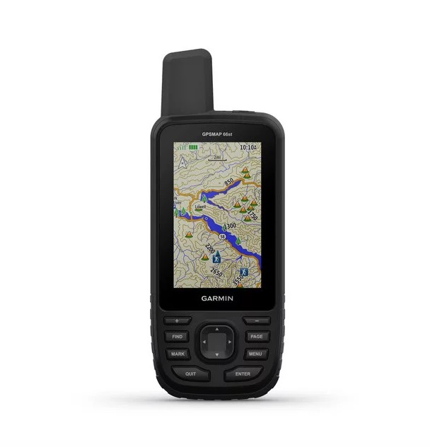
The Garmin GPSMAP 66st is a turbocharged version of the GPSMAP 64 series. Garmin doubled the internal memory, adds additional options for connectivity, and beefed up the frame to military specifications for thermal and shock resistance. On the "t" model, they also included pre-loaded TOPO maps and the capability for downloading BirdsEye satellite imagery without a subscription.
Performance Comparison
Reception
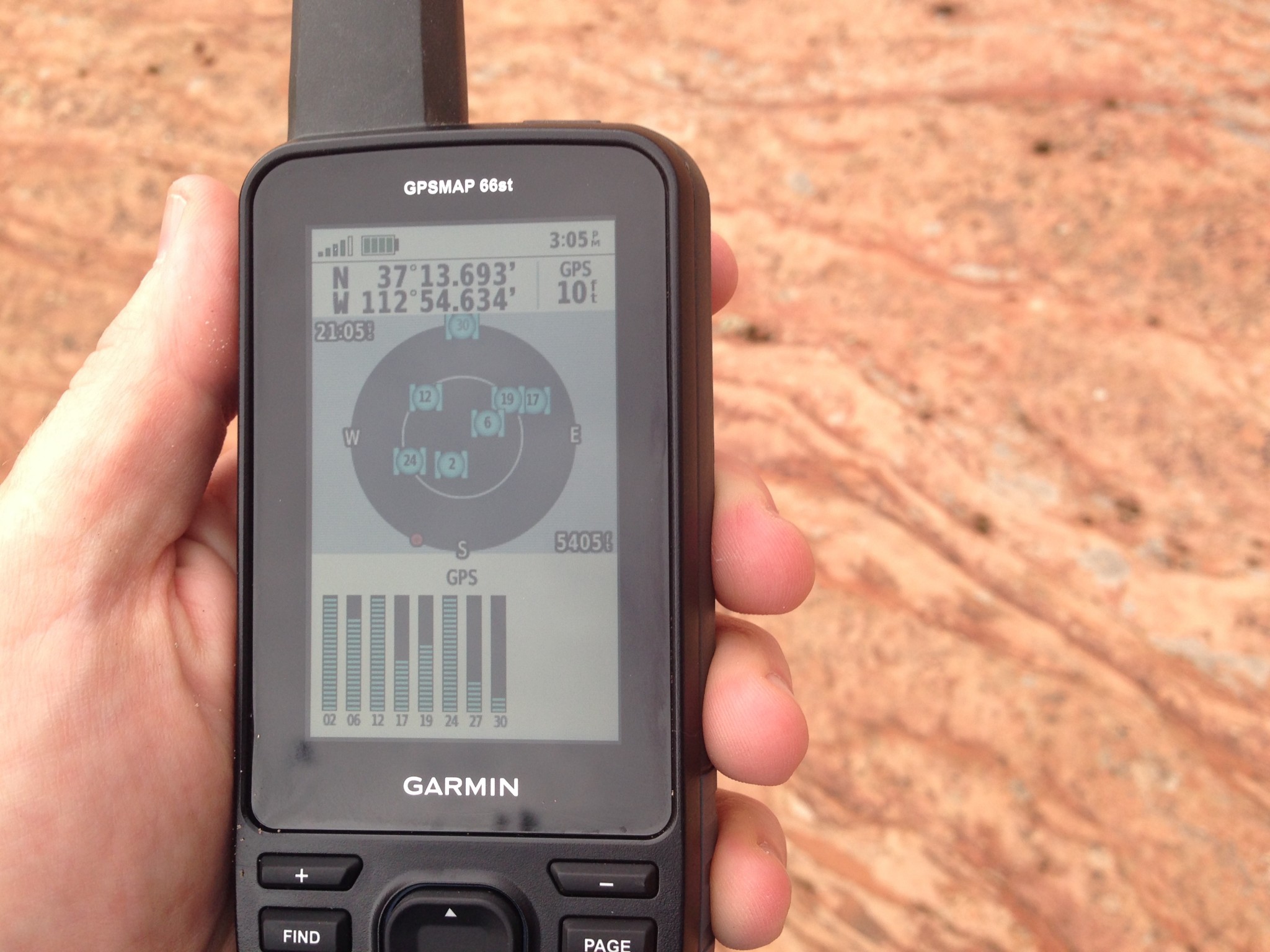
The GPSMAP 66st has excellent reception for a few reasons. First, the actual construction of the antenna is a quad-helix design, which is quite sensitive and better than some other designs in tree cover or low satellite angles. The 66st also uses three different satellite systems: GPS (North America), Galileo (EU), and GLONASS (Russia) allowing the most amount of satellites for triangulation, making this a really accurate unit.
In the field, we found the 66st to live up to its reputation. When mapping old mountain biking trails in Southwestern Utah, we were able to leave and easily pick up the trail again, rather than being forever lost among the sea of junipers.
Ease of Use
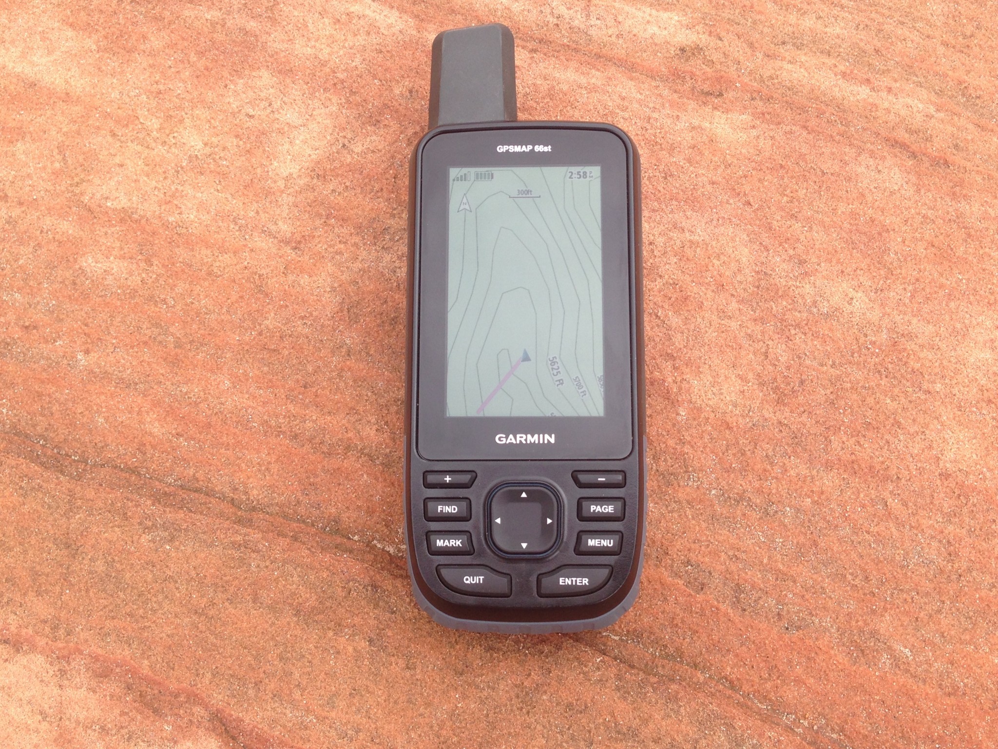
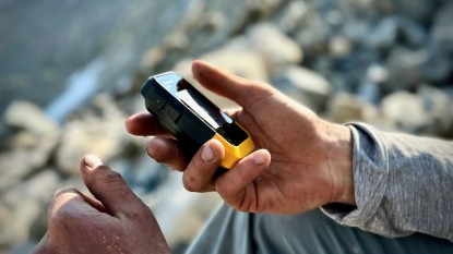
The GPSMAP 66st was one of the easiest units to use straight from the get-go that we tested. All the buttons are large and have easy-to-read labels on each one. Unlike some of the other units, the 66st buttons are pretty straightforward, and there are enough of them for each to have a distinct function in a particular setting.
While some folks may prefer a touchscreen, we really liked the big buttons on this unit, especially in the cold. The 66st functionality works great regardless of conditions, whether it's freezing or wet. The buttons are big enough to push with gloves on, and there's no touch screen to get wet and inoperable. Like most of Garmin's handheld units, it's rated to IPX7 water resistance, which means it's good to go for rainstorms or snow, just not full immersion.
As the functions get more in-depth, the controls do get more complicated, but that's to be expected. Some of the pairing with other devices and apps took a lot of back and forth registration and pairing, which was a hassle, but only a one-time inconvenience.
Display Quality
With the transflective TFT display on a three-inch screen, the 66st is really readable, even in sunlight, which is really nice on snow or on a bright, sunny day.
The 240x400-pixel display is nice when viewing photos or satellite imagery on the Bird's Eye function, but otherwise, we'd be hard-pressed to tell much of a difference otherwise. Unlike the touchscreens, the 66st does not rotate from a portrait view, but it wouldn't really make sense to on this unit.
Speed
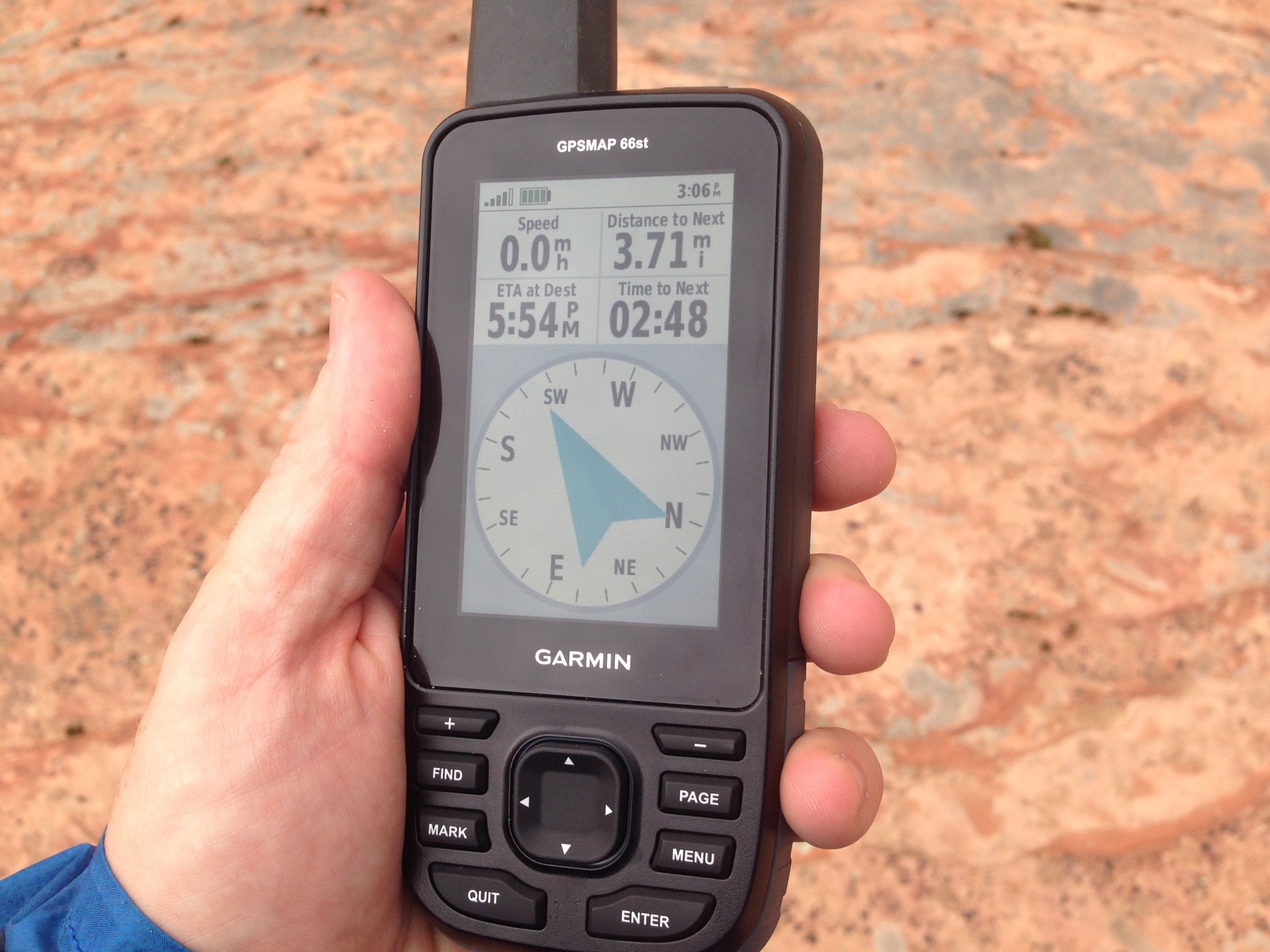
Like most of the button-operated GPS units we tested, the 66st isn't quite as responsive in function as some of the touch-screen units we tested, but it wasn't slow enough to be noticeable or create any issues from the slight lag.
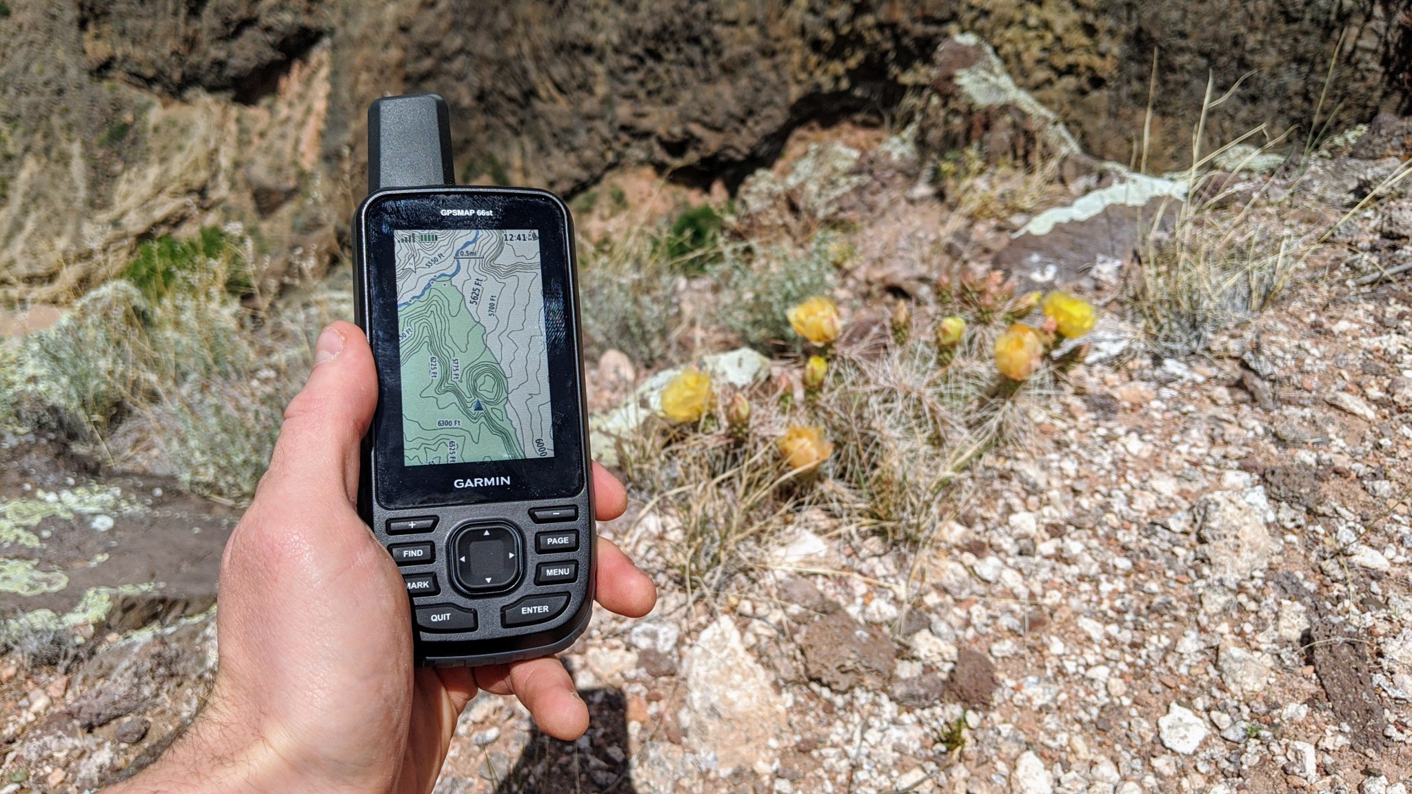
It did actually draw maps quite fast, fast enough for the maps to be redrawn almost as fast as a pan across the map, depending on the scale. It also can go through a lot of data quickly, and it doesn't take much time to load new big route files or bird's eye satellite images.
Weight and Size
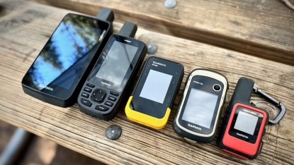
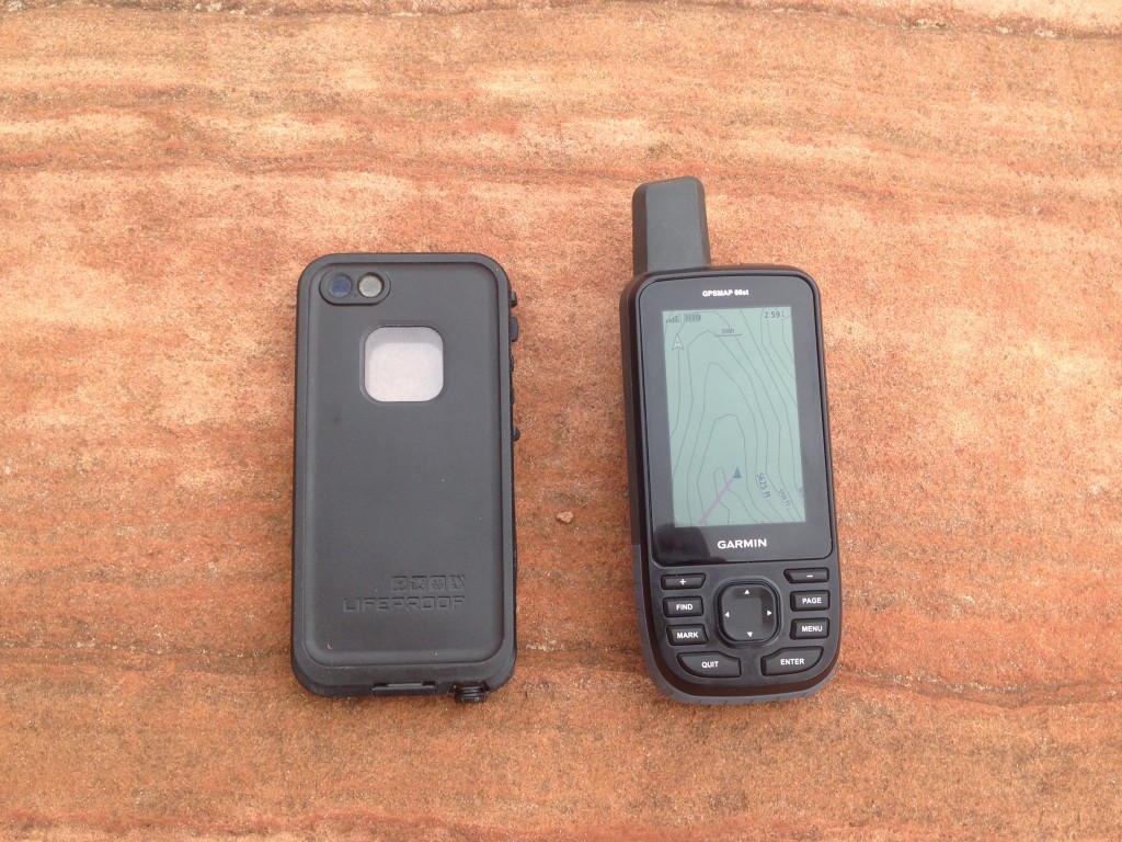
At eight ounces, the 66st is one of the heaviest units in the review. On one hand, 8 ounces isn't that much. On the other hand, it's half a pound, which seems like a lot when considering something that is the size of your cellphone.
It fits into most jacket pockets, but it's big enough that hiking with it in a pants pocket is annoying. This is definitely not the unit for the ultralighters out there, but rather a serious tool for a lot of information gathering.
Versatility
The GPSMAP 66st is a highly versatile and accurate GPS unit. It's accurate, easy to use, and seems quite bombproof. The battery pack is simply two AAs, which, although not rechargeable, are easily found around the world. Lithium batteries make this thing cold-resistant too, and with the big buttons, it works great for ski touring or other wet and cold activities. We think this thing could be used in any given situation where a handheld GPS is appropriate.
The best thing about the 66st is the way Garmin paired accuracy, ease-of-use, and a heaping helping of memory. For professionals who need to use a lot of data on a GPS unit but don't have the budget for a Trimble, this is a good option. With the 64GB microSD cards now available, the 66st could carry up to 80GB, which is way more than we think we could ever use in the lifetime of a unit without deleting anything.
Provided you're willing to shell out for a high-end GPS unit, this thing will go anywhere. Skiing, backpacking, fieldwork, you name it. It can be put in expedition mode to save battery life on long trips; and can be soaked, knocked, dropped, and the thing keeps kicking. With the military-built specifications, this thing is rugged, and if you add a lithium battery pack, the GPSMAP 66st will work in nearly any environment.
Value
The GPSMAP 66st is one of the most expensive units in our review. The only feature that would have made this more expensive is a touch screen. If you do need the functionality of the 66st, then it's worth it for sure. If you plan on downloading your own maps anyway, you can knock off some of the cost and just get the 66s model, which seems like a pretty good value considering the capability of this line.
Conclusion
For a really capable, really durable GPS unit, the GPSMAP 66st is an excellent choice. It holds more data than anyone but a really dedicated field researcher on a long trip could use, can connect to smartphones and WiFi, and can view the world via maps or satellite imaging. The 66st isn't cheap, but you get what you pay for: a burly, accurate, featured unit; good enough to earn the Editors' Choice Award.
Ad-free. Influence-free. Powered by Testing.
GearLab is founded on the principle of honest, objective, reviews. Our experts test thousands of products each year using thoughtful test plans that bring out key performance differences between competing products. And, to assure complete independence, we buy all the products we test ourselves. No cherry-picked units sent by manufacturers. No sponsored content. No ads. Just real, honest, side-by-side testing and comparison.
Learn More